
Your cart is currently empty!
Queets River

Queets River – 11.8mi / 18.9km
Mammoth trees and a fantastic river with very few visitors make this rain forest a true delight. Start at the signed trail for the Sams Loop Trail and take a left at the first junction.
The trail drops down to the gravel bars at the confluence of the Sams and Queets Rivers. (This ford can be particularly dangerous in the spring, so wait until the water level has gone down in summer before attempting.) Stay to the right, crossing each river individually above the confluence, then follow the bank downstream on the far side of the Queets River to find the trail (don’t be fooled by the dry gravel beds).
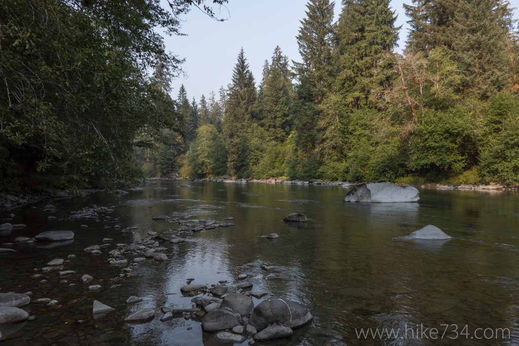
The trail is easy traveling from here as it cruises through the rain forest. The lush forest is a collection of seemingly unlimited plant species. Ferns of many varieties are strewn about the forest floor while moss grows everywhere and hangs like lace from giant maples. A large, grassy meadow has remains of an old homestead at its northern end.
Just before you cross over Coal Creek, an old rough trail takes you to what was the largest living Douglas fir in the world. The trail eventually joins back up with the delightful Queets River with wonderful vantages both above the river and right alongside. Spruce Bottom Camp is perched above a large bend in the river.
Continue 0.2mi/0.3km past the camp to enter a sublime stand of red alder that creates a swooping tunnel of trees before turning around.
Trailhead: Turn north on NF-21/Boundary Rd (look for Upper Queets Valley sign) from Hwy 101 halfway between Aberdeen and Forks (just west of Lake Quinault). Follow signs for Upper Queets on NF-21 and bear left onto gravel road NF-2180 and left again as the road enters the national park and drops into the Queets valley. Take a right and follow the road to the trailhead at the end of the road.
Elevation Gain: 200ft / 60m – Elevation Loss: 200ft / 60m