
Your cart is currently empty!
Search results for: “JN0-363 Actual Real Questions – JN0-363 Test Guide – JN0-363 Exam Quiz 😈 Search for ( JN0-363 ) and download exam materials for free through 「 www.pdfvce.com 」 🍯Exam JN0-363 Quick Prep”
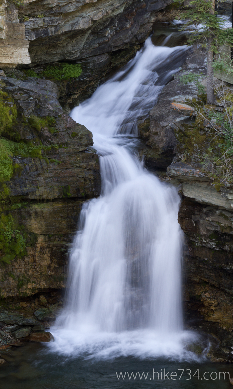
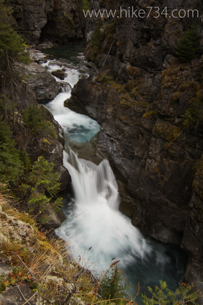
Blakiston Falls & Snowshoe Trail – Waterton Lakes National Park
—
by
The Blakiston Falls Trail starts right at the end of the Red Rock Parkway where there are bridges and interpretive signs for the three creeks that come together as one. A short walk up Blakiston Creek brings you to the lovely Blakiston Falls where there are two different vantage points. Beyond that, the trails meanders…
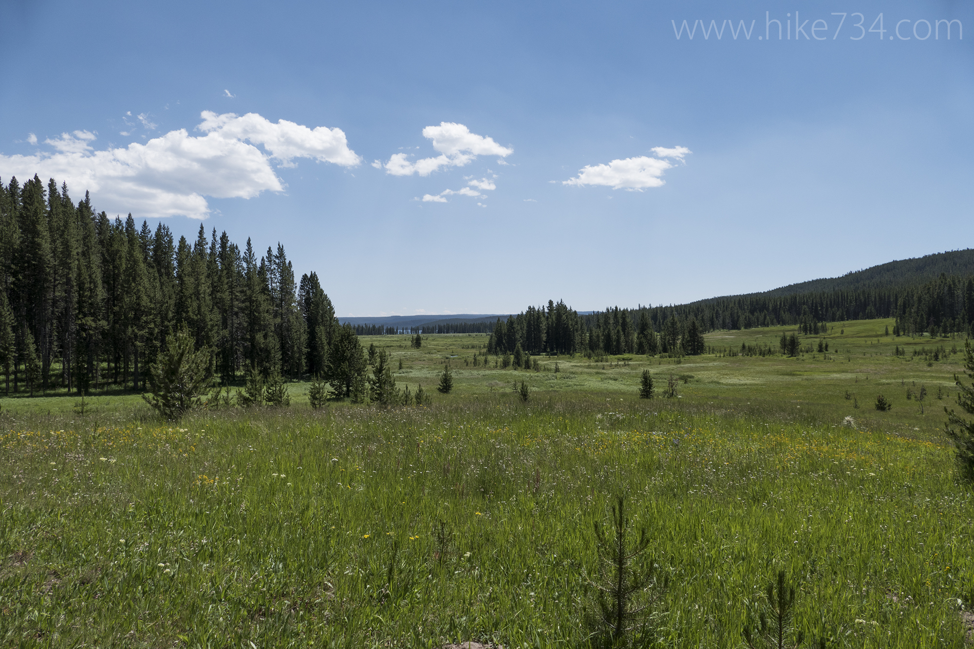
Shoshone Lake via DeLacy Creek
—
by
Shoshone Lake via DeLacy Creek – 6mi / 9.6km The shortest hike to the beautiful Shoshone Lake is via the level DeLacy Creek Trail. The trail immediately enters the woods and drops down to the creek. From here, the creek gurgles through a mature stand of lodgepole forest. The trail eventually breaks into picturesque meadows lined…
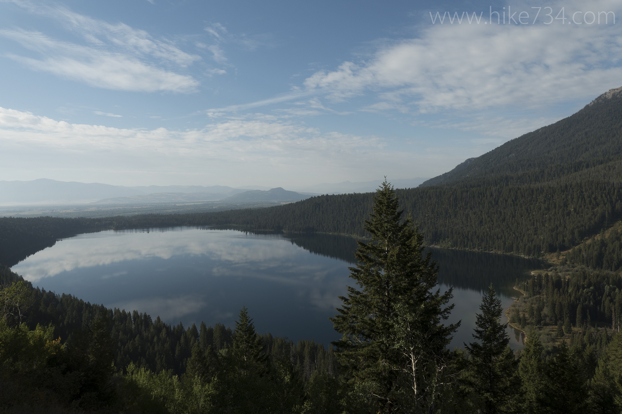
Phelps Lake Overlook
—
by
Phelps Lake Overlook – 1.8mi / 2.9km Inspiring views of Phelps Lake await at the end of this short out-and-back hike. This is the shortest route to the overlook, but it can also be accessed when hiking the trail that loops around Phelps Lake. (See Phelps Lake Loop for description.) This trail starts in a lush…

Emma Matilda Lake Loop
—
by
Emma Matilda Lake Loop – 10.8mi / 17.3km This hike visits Christian Pond before looping around the lesser-visited Emma Matilda Lake, a larger, kidney-bean shaped lake tucked between two forested ridges. The trail starts near the corrals at the Jackson Lake Lodge and heads to the top of the moraine that overlooks Christian Pond (see…
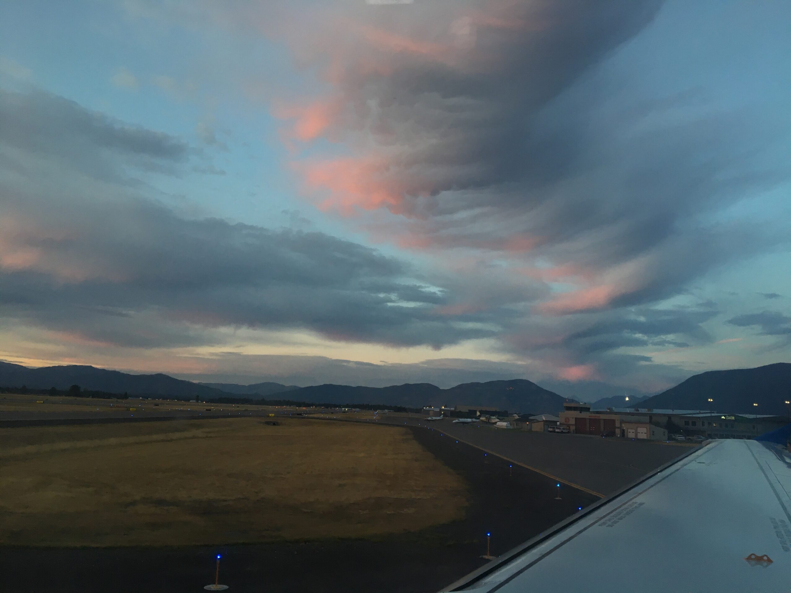
Back down to Yosemite National Park
—
by
As the sun was setting in western Montana, my plane was rising up to the colorful clouds. Time to once again head back down to Yosemite National Park. I’ve been back and forth all summer long as I work on my latest day hike map. Yosemite is a wonderful park and I hope this map…
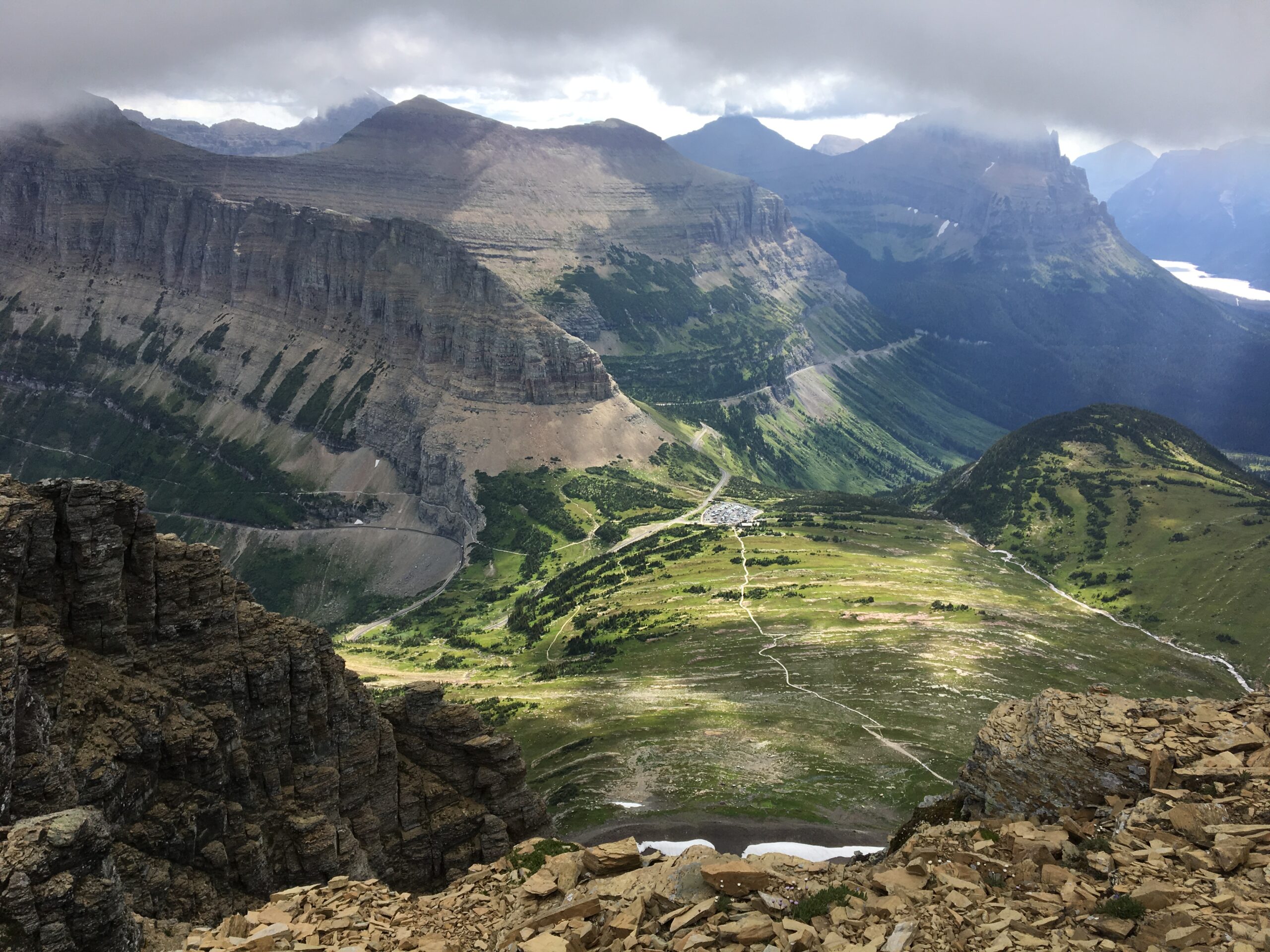
Climbing Clements Mountain
—
by
Every once in awhile I like (love) to take off my camera and binoculars and trade it for the lightest running pack I have. On Sunday, Kristen and I lightly loaded up our running packs and headed for the hills. We arrived up at Logan Pass in Glacier National Park along with a string of…
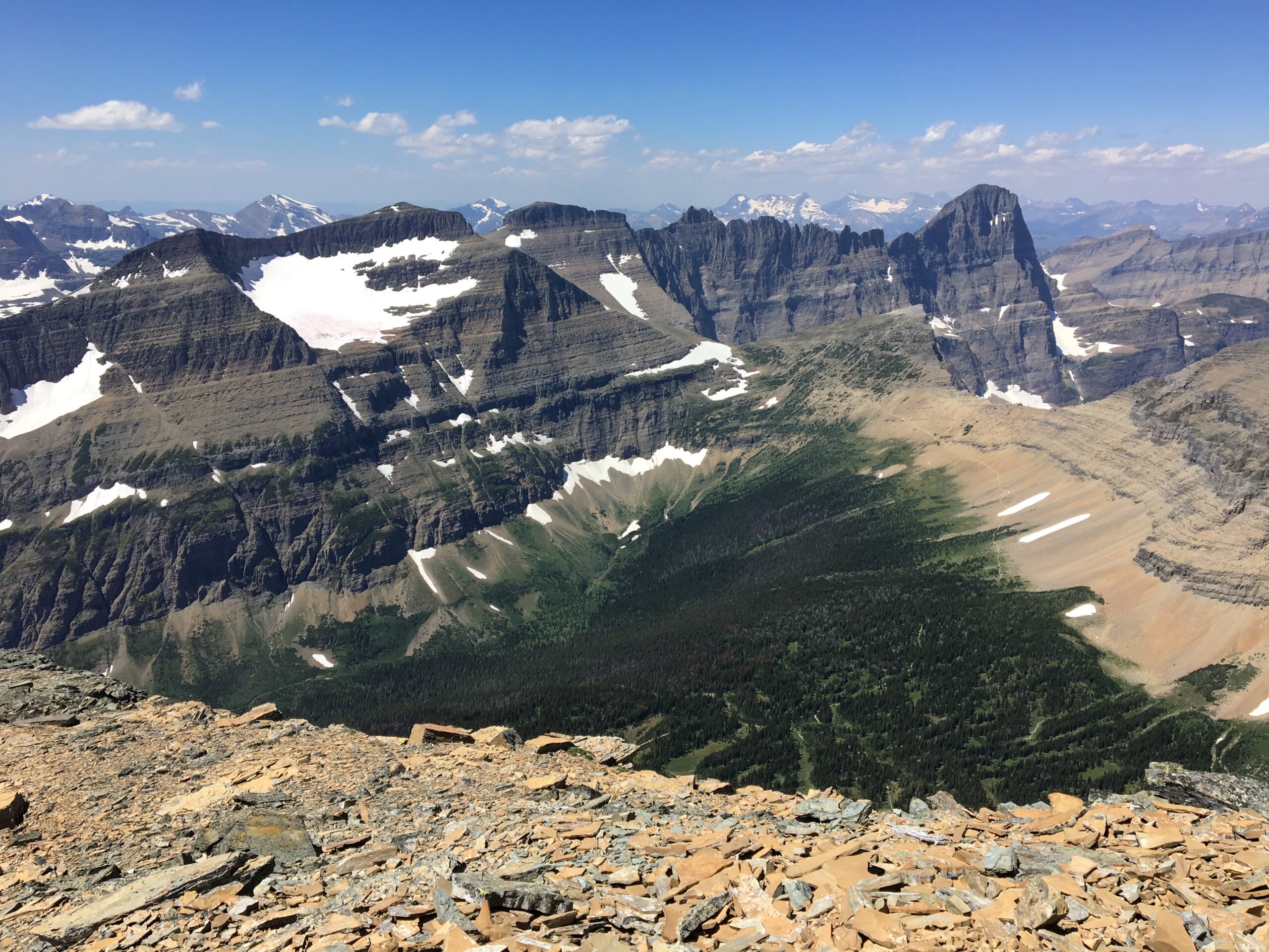
Matahpi Peak
—
by
“So now what should we do?” we both said as we looked at one another. Kristen and I had arrived at Logan Pass at 9:30am on Saturday which meant that we couldn’t park in the parking lot because it was already full. After driving down to Lunch Creek to park and walking back up to…
Coal Nyack Loop
—
by
While most visitors to Glacier National Park stay around Going to the Sun Road with ventures to Many Glacier and Two Medicine, the furthest north and the furthest south tend to get the least amount of attention. Few places exemplify this more than the Coal Nyack region. The Coal Nyack Loop is accessed either from…
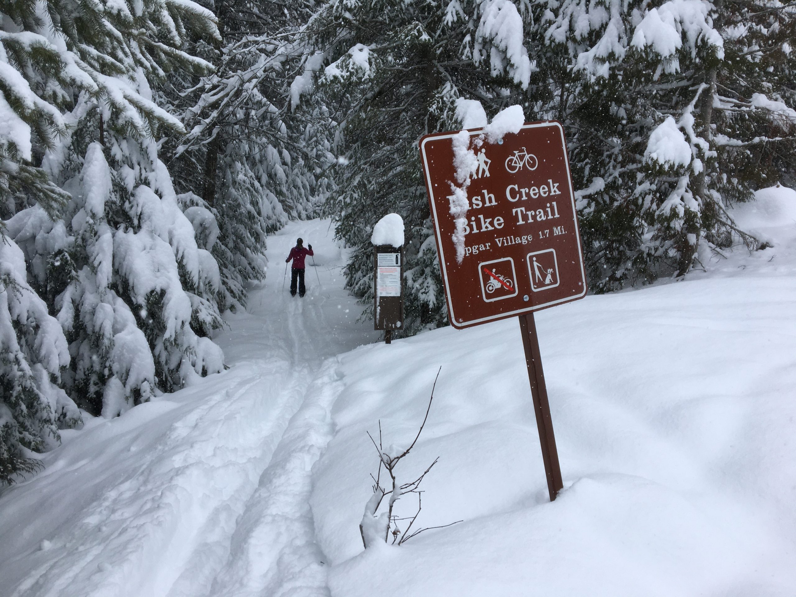
Skiing Grist Road to Fish Creek
—
by
If you head west from Apgar in Glacier National Park and cross over McDonald Creek, the first road on your right is called Grist Road. Along this quaint road are a collection of private inholdings. The road dead-ends and one of Glacier’s few “bike-able” trails continues on to the Fish Creek Campground Road. I wouldn’t…