
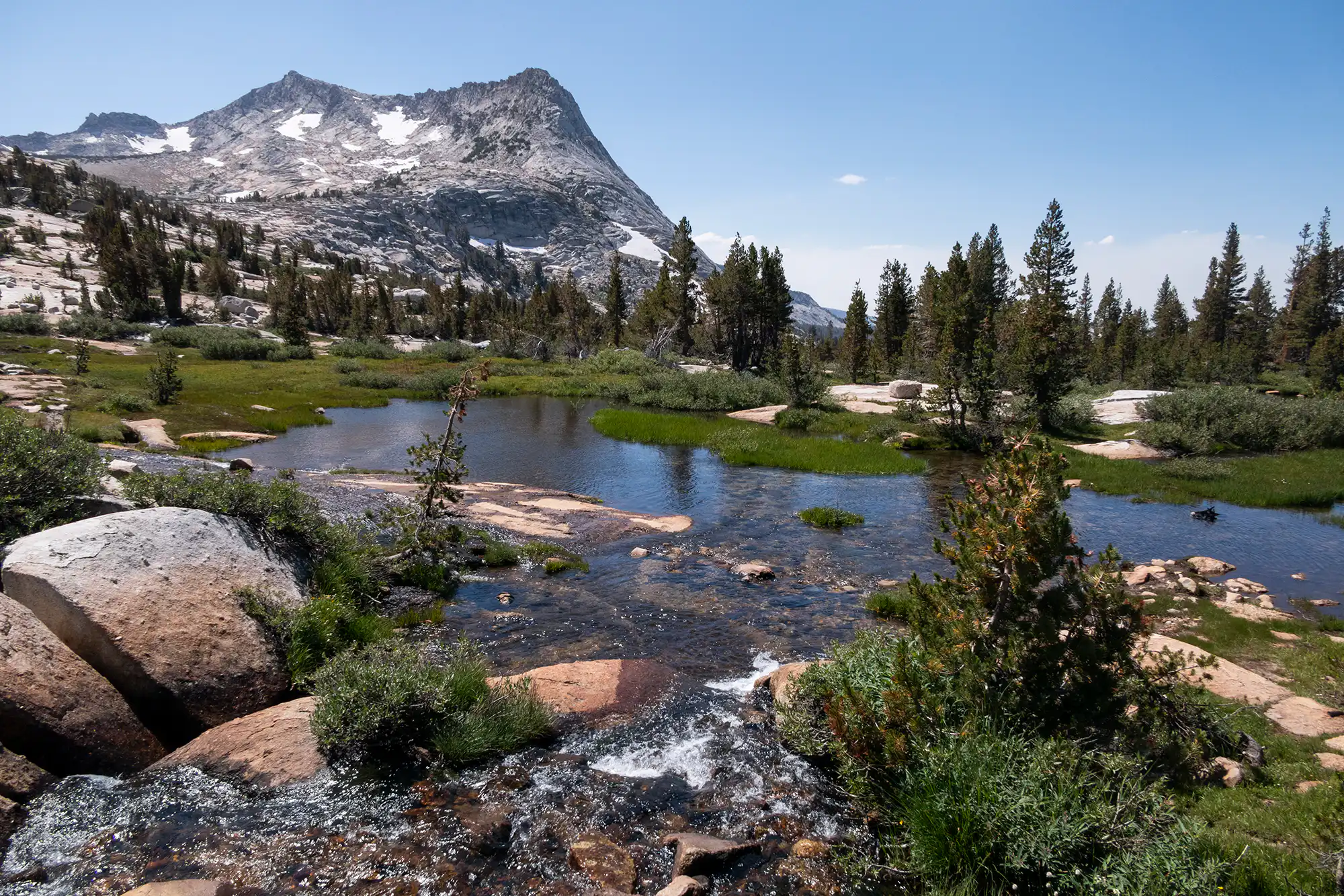
Yosemite is defined by towering granite walls, massive trees, cascading waterfalls, and sweeping views from iconic domes and ridgelines. From valley-floor hikes to more challenging climbs, the hiking in Yosemite is diverse and spectacular.
But navigating the park and trying to decide which hikes and what regions to explore can be challenging.
- Which hikes are right for me?
- How do I get a permit for Half Dome?
- Will the shuttle take me to the trailhead?
Plan, hike & explore with confidence
Yosemite’s hiking is abundant, and each region offers a different hiking experience— we’re here to help you make the most of every moment.
Whether you’re here for a day or a full week, these planning resources will help you choose the right hikes and navigate the park with confidence.
We’re here to help!
Jake’s ranking of every day hike
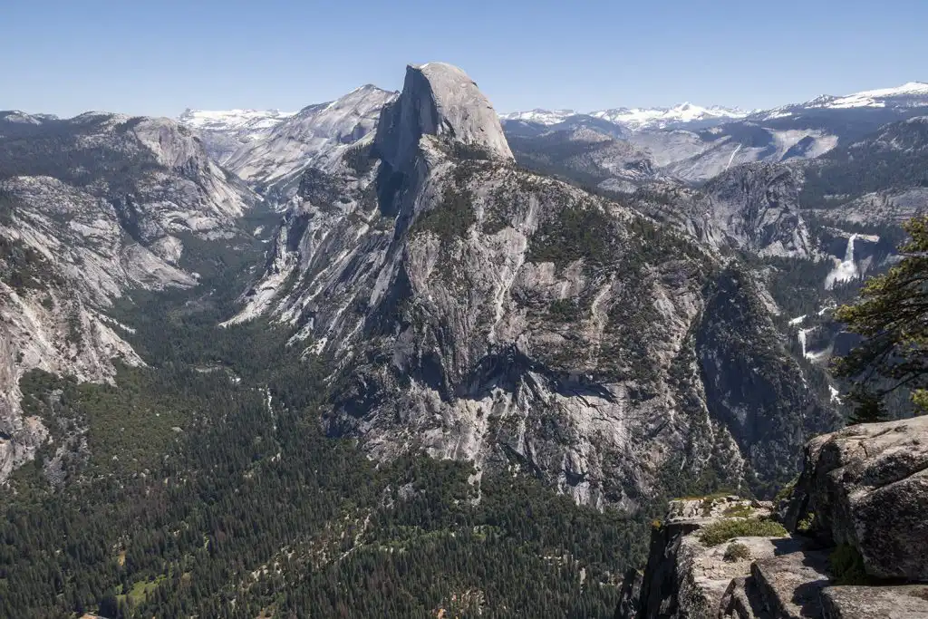
After hiking the trails in Yosemite, Jake created a ranked list of every day hike. The ranking system is based upon which hikes Jake feels will give you the most “bang for your buck” — starting with the iconic hike up to the top of Half Dome.
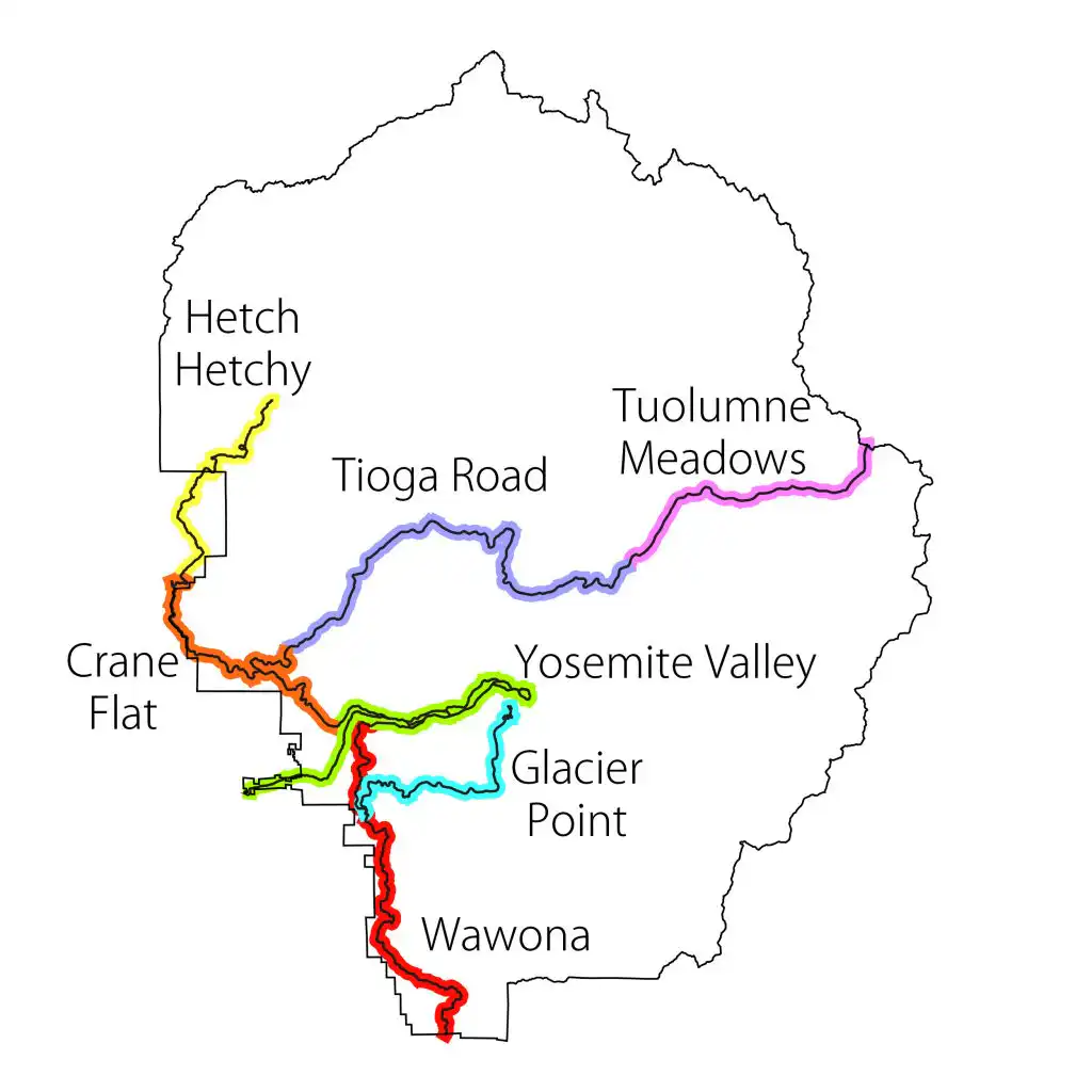
Use the table below to learn more about the park regions and corresponding hikes.
Trip reports & trail videos
See what the hikes actually look and feel like. Our Yosemite trip reports and videos show trail conditions, scenery, and what to expect before you step foot on the trail.
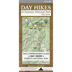
Yosemite Day hike Map guide
Your all-in-one planning and hiking resource!
All the visual information of a topographic map paired with expert recommendations and all the trail and park specific details of a guidebook — it’s waterproof, lightweight and fits into any backpack.
Regions of Yosemite National Park:
- Crane Flat
- Glacier Point
- Hetch Hetchy
- Tioga Road
- Tuolumne Meadows
- Yosemite Valley
- Wawona
Note: All of this information and more is included in the Day Hikes of Yosemite National Park Map Guide — make sure you have it in your backpack when you hit the trail!
- Click each trail name to learn more about the hike
- Click on table headers to sort by that column
Rank Name Distance Group Area 1 Half Dome 15+ Yosemite Valley 2 Glacier Point 0-5 Glacier Point 3 Lower Yosemite Fall 0-5 Yosemite Valley 4 Nevada Fall Loop 5-10 Yosemite Valley 5 Yosemite Falls 5-10 Yosemite Valley 6 Four Mile and Panorama 10-15 Yosemite Valley 7 Bridalveil Fall 0-5 Yosemite Valley 8 Upper & Lower Mariposa 10-15 Wawona 9 Clouds Rest 10-15 Tioga Road 10 Panorama Trail 5-10 Glacier Point 11 Sentinel Dome/Taft Point Loop 5-10 Glacier Point 12 North Dome 5-10 Tioga Road 13 Cathedral Lakes 5-10 Tuolumne Meadows 14 Waterwheel Falls 15+ Tuolumne Meadows 15 Vogelsang High Sierra Camp 10-15 Tuolumne Meadows 16 Mount Hoffman 5-10 Tioga Road 17 Vernal Fall 0-5 Yosemite Valley 18 Four Mile Trail 0-5 Glacier Point 19 Ostrander Lake 10-15 Glacier Point 20 Lembert Dome 0-5 Tuolumne Meadows 21 Pothole Dome 0-5 Tuolumne Meadows 22 Gaylor Lakes 0-5 Tuolumne Meadows 23 Wapama Falls 0-5 Hetch Hetchy 24 Glen Aulin 10-15 Tuolumne Meadows 25 Ten Lakes 10-15 Tioga Road 26 Lower Mariposa Grove 0-5 Wawona 27 May Lake 0-5 Tioga Road 28 Mono Pass 5-10 Tuolumne Meadows 29 Elizabeth Lake 0-5 Tuolumne Meadows 30 Lukens Lake 0-5 Tioga Road 31 Stanford Point 10-15 Glacier Point 32 Dewey Point 5-10 Glacier Point 33 Sentinel Dome 0-5 Glacier Point 34 Olmsted Point 0-5 Tioga Road 35 Lower Gaylor Lake 0-5 Tuolumne Meadows 36 Chilnualna Falls 5-10 Wawona 37 Taft Point & The Fissures 0-5 Glacier Point 38 Rancheria Falls 10-15 Hetch Hetchy 39 Spillway Lake 5-10 Tuolumne Meadows 40 Ireland Lake 15+ Tuolumne Meadows 41 Lyell Canyon – Short 5-10 Tuolumne Meadows 41 Lyell Canyon 15+ Tuolumne Meadows 42 Dog Lake 0-5 Tuolumne Meadows 43 Grant Lakes 10-15 Tioga Road 44 El Capitan 15+ Tioga Road 45 Sunrise Lakes 5-10 Tioga Road 46 Soda Springs 0-5 Tuolumne Meadows 47 Mirror Lake Loop 0-5 Yosemite Valley 48 Pohono Trail 10-15 Glacier Point 49 Young Lakes 10-15 Tuolumne Meadows 50 Twin Bridges of Lyell Fork 0-5 Tuolumne Meadows 51 Smith Peak 10-15 Hetch Hetchy 52 Mirror Lake 0-5 Yosemite Valley 53 Tenaya Lake 0-5 Tuolumne Meadows 54 Cook’s Meadow Loop 0-5 Yosemite Valley 55 Illilouette Fall 5-10 Glacier Point 56 Carlon Falls 0-5 Crane Flat 57 Merced Grove 0-5 Crane Flat 58 Mount Starr King View 0-5 Glacier Point 59 Tuolumne Grove 0-5 Crane Flat 60 Kibbie Lake 10-15 Hetch Hetchy 61 Lookout Point 0-5 Hetch Hetchy 62 Foresta Falls 0-5 Crane Flat 63 Snow Creek Trail 5-10 Yosemite Valley 64 Inspiration Point 0-5 Yosemite Valley 65 Valley Loop Trail – Half Loop 5-10 Yosemite Valley 66 Valley Loop Trail 10-15 Yosemite Valley 67 Polly Dome Lakes 5-10 Tioga Road 68 Swinging Bridge 0-5 Wawona 69 McGurk Meadow 0-5 Glacier Point 70 Poopenaut Valley 0-5 Hetch Hetchy 71 Crane Flat Lookout 0-5 Crane Flat 72 Wawona Meadow Loop 0-5 Wawona 73 Grand Canyon of the Tuolumne River 5-10 Tioga Road 74 Harden Lake 5-10 Tioga Road 75 O’Shaughnessy Dam to Tuolumne River 0-5 Hetch Hetchy 76 Falls on Alder Creek 10-15 Wawona 77 Yosemite Creek 0-5 Tioga Road 78 Cascade Creek from Tamarack CG 0-5 Tioga Road
Half Dome – How to get a permit
Climbing the iconic Half Dome is a classic experience and should be on any visitor’s list who is physically capable. Due to the popularity of the climb, the park service has a permit system in place when the cables go up. You can hike without a permit to the base up subdome, but can go no further. The cable section on Half Dome requires a permit.
PRESEASON LOTTERY
The target limit is 300 hikers per day with 225 being available for day hikers and 75 being available for backpackers as part of the preseason lottery which runs from March 1st – March 31st. You can apply for that lottery by going to the Cables on Half Dome Permits page on Recreation.gov during the month of March.