The ridgeline that contains Spot Mountain and Red Mountain is a beautiful behemoth that rarely gets climbed. Kristen and I decided to tackle these two summits in the Two Medicine area of Glacier National Park and we were rewarded with expansive views along this long ridge.
It involved a little bit of bushwhacking and some fun route-finding, so it’s only recommended for those with experience climbing in Glacier. If you do, and you’re looking for a beast to tackle, this one is a great choice.
We started out by the Two Medicine entrance on the Dry Fork Trail that connects up with the Oldman Lake Trail which is part of the Dawson-Pitamakan Loop. After traveling through the lovely trees and gaining a small amount of elevation, I decided to take us up a meadow and through some trees. In hindsight, I would have walked a little bit further to the dry creek bed, but it gave us a little bit of bushwhacking (which builds character). 😉
Once through the thickest part, we met up with the dry creek bed which was much easier to climb. As we ascended into the bowl below Spot Mountain, we found certain sections of the creek still flowing. This is always fun for me as the underground hydrology is invisible to us.
As we got further up, we broke off from the creek and navigated our way up a slope that was a mix of rock, low growing shrubs and short trees bunched together called krumholtz. The summit is a rounded affair which makes you feel like you are ascending a basketball. Once, however, we felt like we were on the top of the shoulder, the summit was quick to come to us where we ate lunch.
Staring in front of us what the red hulk of a shoulder giving the mountain its name. We started walking along the rounded ridgeline, then navigated the next two rocky humps along the spine by simply walking over them. On the last one, we studied the features and figured that we could probably just follow the top of the ridgeline unless it got too dicey. We’d either find a route or turn around. Once below some cliffs, we’d traverse on the scree, then climb up to the higher ridge.
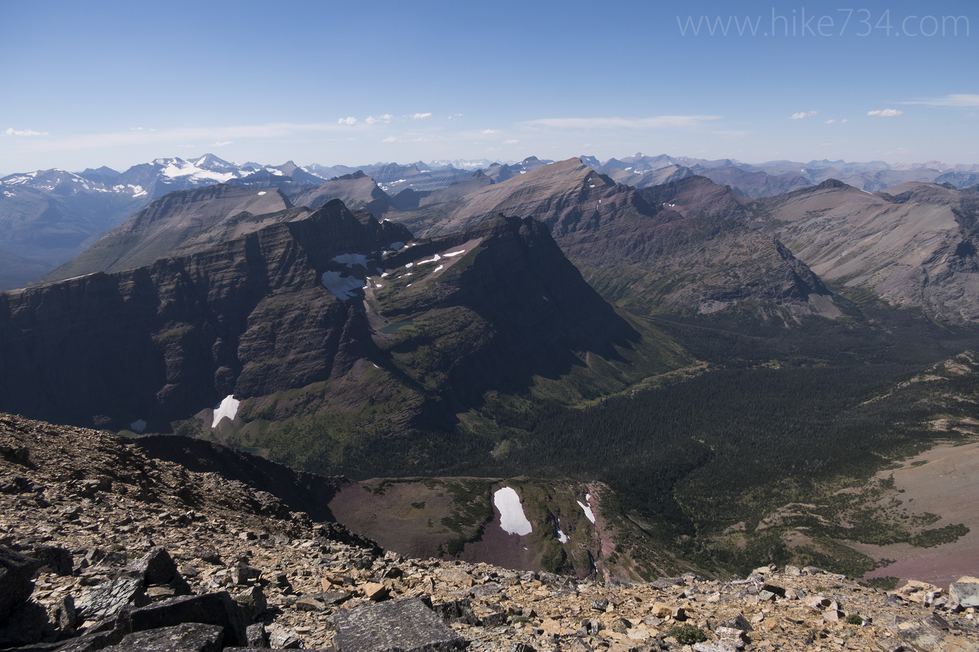
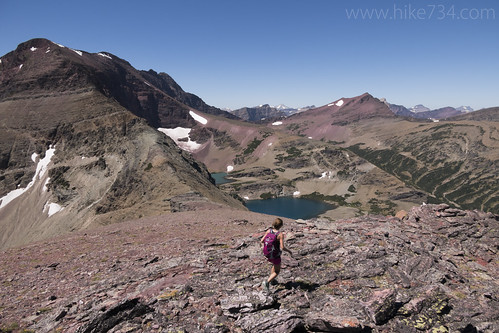
As we approached each feature, it turned out to be perfect for sticking right to the ridge which was delightful both in ease and views. The rainbow of colors of the rock continued to delight from tans and golds to red, blues, and greens. To the north were Lonely Lakes which were two lakes stacked one after the other with the upper lake a wonderful turquoise and the lower a cobalt blue.
We traversed the base of the cliffs, coming across a section of rocks that looked like cliff dwellings in miniature. Just past them, we found scrambles up the cliffs much sooner than we thought and, after a bit of climbing, found ourselves looking at the long ridge. At this point, we could see how much day we had left and it was a lot.
The views, however, were happy, peak-laden, panoramic goodness. The ridgeline was fun with a few sections that forced us for a few yards to leave the ridge. We jumped a pair of White-tailed Ptarmigans along the way. A juvenile Golden Eagle that we’d been watching made another appearance and, towards the end of the ridge, we watched a Prairie Falcon hunt for prey amongst the rocks.
More unnamed lakes continued to show up in addition to the appearance of Running Crane to the north. We were a little nervous about the last pitch as we had an idea that we could find a route, but from a distance, we weren’t sure. As we approached the summit, we found the goat trail that dropped down and traversed to the base of the last climb. From there, we followed a couple of chutes up to the summit.
What a wonderful summit! This summit is particularly fun for the wonderful ridge walk. A little further west we found even better views that looked down onto the lakes below Pitamakan Pass that are such a delight, including Katoya Lake which isn’t visible from the Pitamakan-Dawson Loop.
From that vantage, we decided to work our way west, down the slopes to join up with the Oldman Lake Trail. It involved following the ridge down to a saddle, joining up with a goat trail under some cliff bands to another saddle, then either going out a valley to the trail, or up another ridge to Pitamakan Pass and joining the trail there.
We were hoping that we didn’t have to climb up to Pitamakan Pass. To our delight, we reached the saddle after the goat traverse and found a wonderful valley full of flower meadows. We walked that down to the treeline, endured a short bushwhack, and were back on a trail. From there, we hauled out and got to our car.
The climb was approximately 16.5 miles for the loop with around 5,000ft elevation gain/loss. We did it in about 12 hours, but weren’t pushing it… we weren’t lolligagging around either!
It’s a wonderful climb for those looking for a longer day. We only saw two cairns the whole day which marked the summits. It’s a fun route because there is so much great route-finding, but I wouldn’t recommend it to those with limited climbing experience in Glacier. You can do each summit separately for shorter days, but we found a great, full day climbing Spot Mountain and Red Mountain in Glacier National Park by combining them and turning it into a loop.


Leave a Reply