Mount Hoffman – 6mi / 9.6km

Panoramic views stretch in all directions from the summit of Mt. Hoffman at the geographic center of Yosemite. The trail works its way up through a granite expanse with a forest growing through the cracks in the rocks. After a steeper switchback section, the trail descends into the trees to May Lake (see May Lake for details).
At May Lake, keep left to wrap around the south end of the lake, crossing over the outlet stream. The trail scrambles up through the ridge on the edge of the boulder field. Views abound as you climb. The trail levels and continues to wrap around to the south side of the mountain through shrubs and forest before making an earnest assault on the mountain.
Keep an eye out to your right for helpful cairns when a large draw appears on your left. While there is no real trail visible, numerous routes up through the large boulder fields are marked with cairns and become more obvious the higher up you go. All routes come together as an established trail forms and works its way west below one of the tall rock formations. The trail traverses across a slanted meadow filled with Yellow-bellied Marmots.
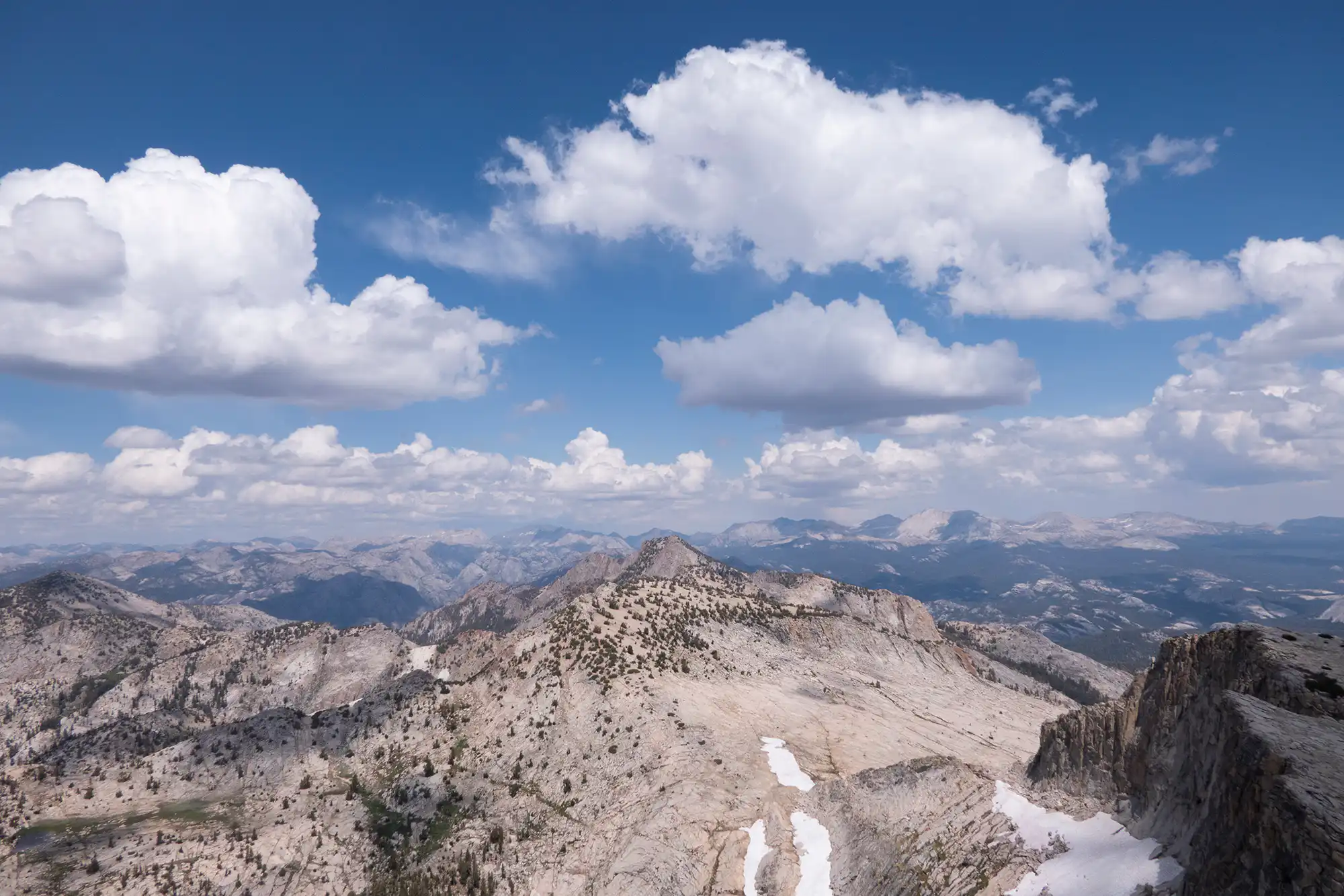
The summit is reached via some easy climbing up the granite where a radio antenna sits. While views have been spectacular on the way up, the summit reveals amazing views of the mountains and drainages to the west. All of Yosemite seems visible from here. Explore the exceptional terrain featuring numerous rock formations in the alpine meadow.
Trailhead: Look for the May Lake trailhead sign off Tioga Road and turn on the road to May Lake. The trailhead is at the end of the road.
Elevation Gain: 2,000ft / 600m – Elevation Loss: 2,000ft / 600m