
Your cart is currently empty!
Search results for: “JN0-363 Actual Real Questions – JN0-363 Test Guide – JN0-363 Exam Quiz 😈 Search for ( JN0-363 ) and download exam materials for free through 「 www.pdfvce.com 」 🍯Exam JN0-363 Quick Prep”
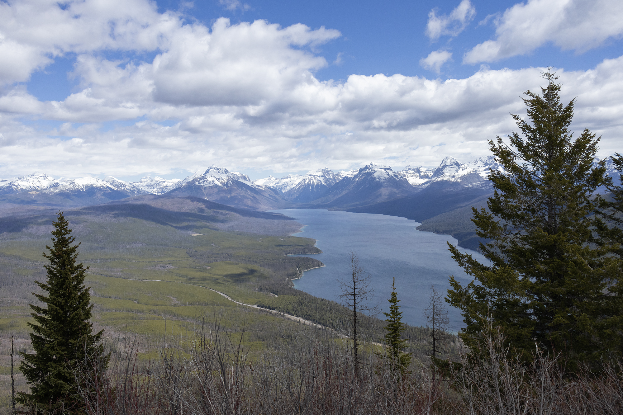
Apgar Lookout Spring 2024
—
by
With the trail being on a south-facing slope, Apgar Lookout is the easiest way to get some elevation in Glacier National Park in the spring. The forecast called for a bluebird day, so we packed our lunches and hit the trail for a lovely spring warmup. Even if Going-to-the-Sun Road was open all the way…
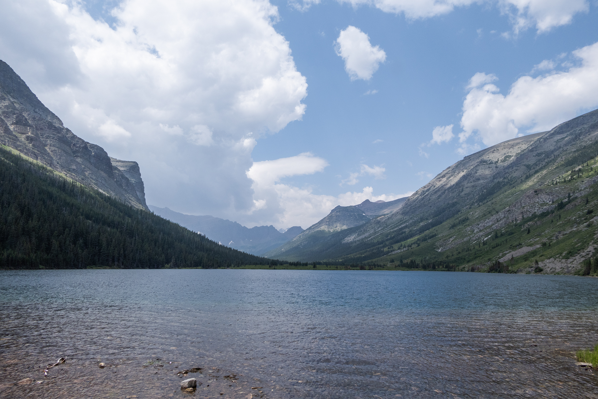
Poia Lake 2023
—
by
The beautiful Poia Lake sits in the Kennedy Creek drainage just north of the main Many Glacier Area of Glacier National Park. With a little bit of effort going over Swiftcurrent Ridge, you can enjoy this beautiful lake in a quieter area of the park. We’ve been doing quite a bit of citizen science work…
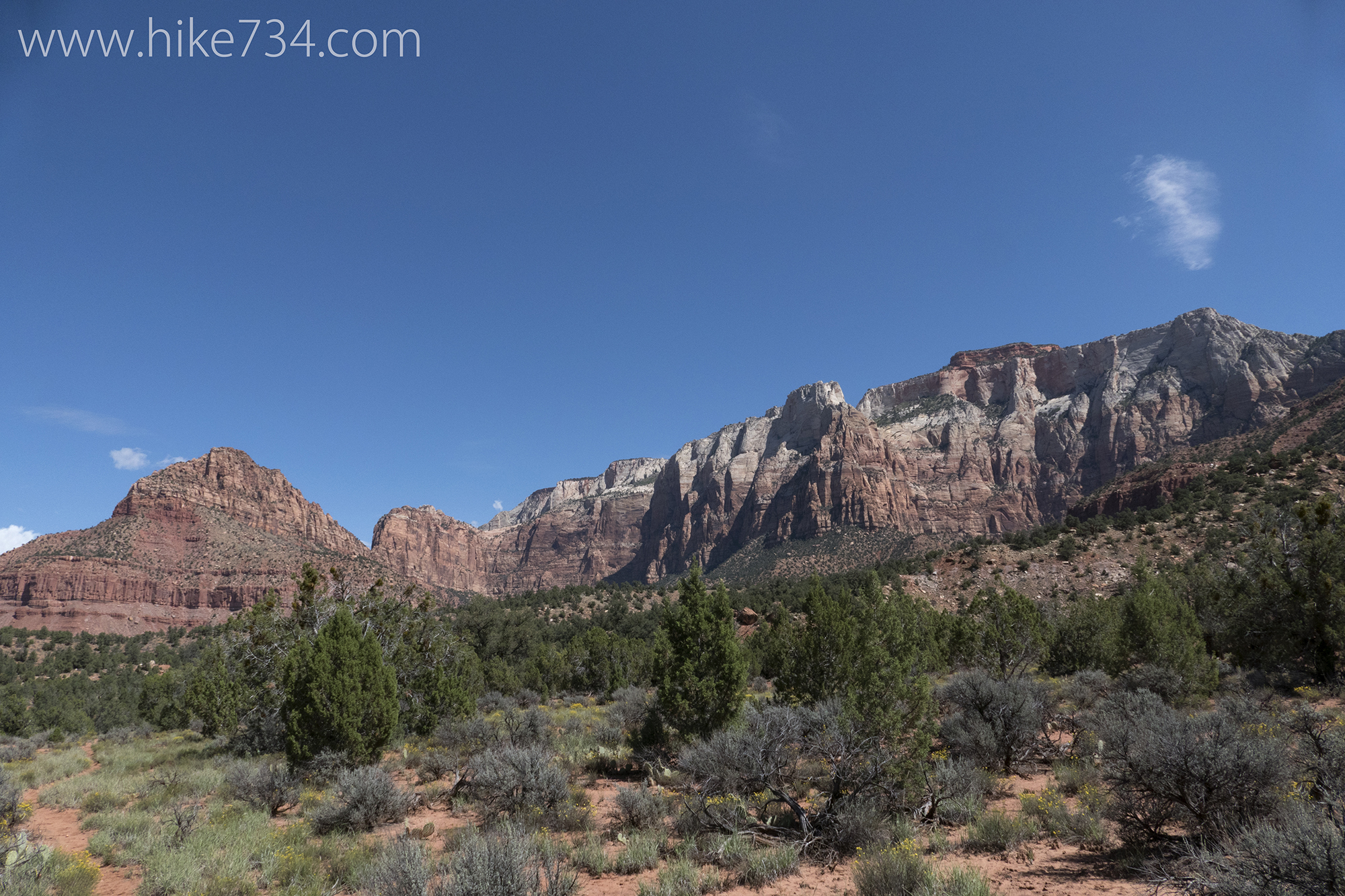
Chinle Trail – Scoggins Wash
—
by
Chinle Trail – Scoggins Wash – 13.4mi / 21.6km There is a nice alternative to simply going out and back along the Chinle trail. It crosses through the desert and the petrified forest, drops down into a wash and loops back up on the trail. Compared to Zion Canyon, seeing people will be the exception along…

Fish Creek Picnic Ski
—
by
When Glacier is all locked in snow, a great place for a spring picnic on a sunny day is Fish Creek Picnic Area. You can snowshoe in, but we skied and enjoyed the beautiful views under a blue sky all while avoiding a chilly wind coming down from the mountains. We parked at the gate…
Interactive Map – Southern Section
—
by
Click on a trail to see the associated blog! For the best Glacier National Park map to take on the trails, purchase the topographic Hike 734 Day Hikes Map with a guide on the back (pictured below). Perfect for both day hikes and backpacking! Back to Main Map
Glacier National Park Trail Map
—
by
Click an area below to take you to a closer look of the area and the trails. For the best map to take on the trails, purchase the Hike 734 Day Hikes Map with a guide on the back (pictured below). Perfect for both day hikes and backpacking!
Interactive Map – Lake McDonald Area
—
by
Click on a trail to see the associated blog! For the best Glacier National Park map to take on the trails, purchase the topographic Hike 734 Day Hikes Map with a guide on the back (pictured below). Perfect for both day hikes and backpacking! Back to Main Map
Interactive Map – North Fork
—
by
North Fork Area Click on a trail to see the associated blog! For the best Glacier National Park map to take on the trails, purchase the topographic Hike 734 Day Hikes Map with a guide on the back (pictured below). Perfect for both day hikes and backpacking! Back to Main Map
Interactive Map – Belly River Area
—
by
Click on a trail to see the associated blog! For the best Glacier National Park map to take on the trails, purchase the topographic Hike 734 Day Hikes Map with a guide on the back (pictured below). Perfect for both day hikes and backpacking! Back to Main Map