Your cart is currently empty!
Ptarmigan – Redgap (including Iceberg Lake)
—
by
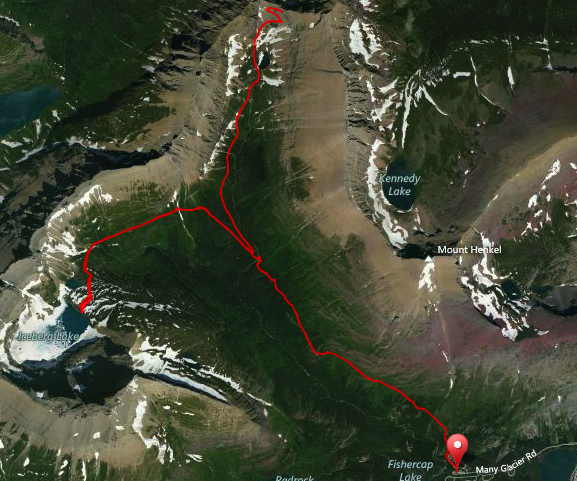
Most visitors to Glacier National Park are looking for great day hikes. In the Many Glacier area, it doesn’t get much better than a trip up to Iceberg Lake and/or Ptarmigan Tunnel. The trail that serves both hikes is often closed due to Grizzly Bear activity, so a planned alternative is recommended, but if you do hike it, you won’t regret it at all!
Iceberg Lake is so named because of the big floating chunks of ice that last well into the summer (some summers more than others depending upon weather). Its shear cliff walls shield those ice chunks from the sun and create a humbling cirque making for a dramatic and unique lake.
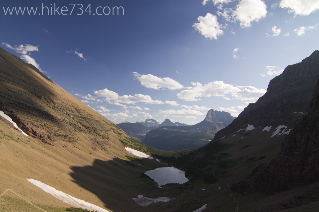
Ptarmigan Tunnel provides an amazing and very unique hiking experience. It was determined that a route connecting the Many Glacier Valley with the Belly River drainage should be put in place and so, in 1930, the 240′ long tunnel was jackhammered and dynamited out of the cliff. (iron doors were hung on each end in 1975 to keep snow out and are opened in Mid-July and closed again on October 1st) The Many Glacier side looks out over Ptarmigan Lake and into the peaks and valleys of Many Glacier with Mt. Wilbur standing prominently. The north side looking into the Belly River drainage shows off the stark red rock that makes the cliff that you traverse and Elizabeth Lake which the trail leads you to. Each step shows more and more of the ridge line that features the 10,004 ft Mt. Merritt and its glacier, Old Sun Glacier. The trees and shrubs are dwarfed due to the dry conditions and fierce wind until you finally get low enough and into the trees.
Elizabeth Lake is a gorgeous lake and has a very pleasant shoreline for lounging. Loons are frequently heard in the morning and an occasional moose is spotted.
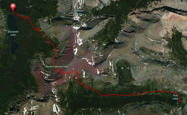
You retrace your steps for about two miles until you come to the trail leading up to Redgap Pass. Once above the treeline, you begin to see more and more peaks. As you get close to the pass, you see a nice bowl that features the headwaters of Redgap Creek. Keep an eye out for Mountain Goats and, if you have it in you, scramble to the easy summit of Seward for a bonus view of the valleys.
Dropping into the Kennedy Creek drainage towards Poia Lake, you’ll get a brief look at the hanging lake called Kennedy Lake. You’ll gradually encounter subalpine fir, and then eventually get swallowed up by trees as you head into the valley bottom. The trail finds its way to Kennedy Creek and beautiful meadows appear. With these meadows, you get views up to the surrounding mountains and a great final approach to Poia Lake.
Poia Lake is another quaint lake nestled in a nice valley. Because of its orientation with the mountains, it gets a lot of afternoon sun. That coupled with a pleasant pebble beach makes for a refreshing dunk after a big sweat-inducing day.
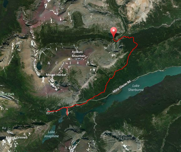
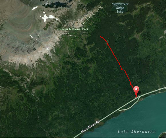
The walk back out to Many Glacier isn’t very notable after the incredible previous two days save for a pretty creek, limestone caves and a smaller lake. You can take the Sherburne Cutoff trail. It is extremely steep, but does cut off a couple of miles and puts you right at the park entrance station. My advice is to head on down to the Apikuni Falls trailhead.
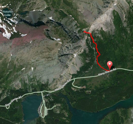
Apikuni Falls is another great little day hike. What the falls lack in power, they make up for in grace as they cascade in big drops. It’s about a mile to the falls and worth the effort.
A few other trails of note is that there is a horse trail that heads back from Apikuni Falls to the Many Glacier Bridge via Apikuni Flat. This trail does cross some small creeks and has no bridges, so you may opt to walk the road or hitch a ride. From the Many Glacier hotel entrance road, you can walk along the Swiftcurrent Lake Nature Trail and the footpath along the road to get back to the Swiftcurrent Motor Inn.
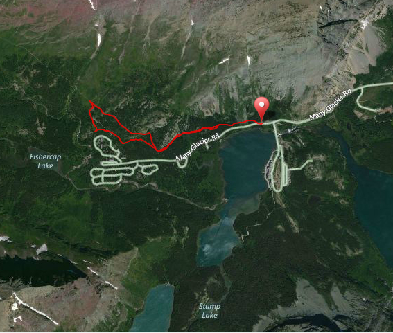
The last section of note is the stretch of trail that most park visitors find is closed. It is known as the Altyn/Henkel stretch of trail (so named as it flanks the base of the two mountains) and is on the north side of the road and overlooks the foot of Swiftcurrent Lake (see last photo below). It is the old horse trail that used to be regularly traveled from Many Glacier hotel. It is a pleasant grade that intersects the Iceberg/Ptarmigan trail that originates from the Swiftcurrent Motor Inn area. (if you ever wondered why the Iceberg/Ptarmigan trail is such a bugger at the beginning, this is why) This area is closed because of the volume of bears that are attracted to the area for food in the fall. Getting ready for winter is a tough job and this is one section set aside for them. The only real reason you’d probably want to hike it is if you wanted to scratch off every mile of trail. It can be easily obtained at the beginning of the year before it’s closed or in October when it opens up again.
Many Glacier to Iceberg Lake and Ptarmigan Tunnel
Ptarmigan Tunnel to Elizabeth Lake
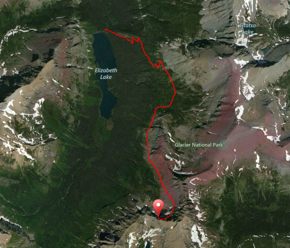
Elizabeth Lake to Poia Lake via Redgap Pass
Poia Lake to Swiftcurrent Inn
Apikuni Falls
Sherburne Ranger Station cutoff trail
Altyn/Henkel trail
Comments
21 responses to “Ptarmigan – Redgap (including Iceberg Lake)”
-
Now I know where you guys went after the Grinell Glacier Hike!! Nice job and great bear shots!
-
Ha! I had been warned about that section from a trail crew guy and was a bit concerned, but was glad I was able to snag it!
-
When you say a hike is 10.5 miles is that one way or is that a round trip?
-
-
-
I’ve been lucky enought to do Iceberg Lake twice. Ptarmagin Tunnel is now on my list! I agree that those flat little rocks on the lake shores are awesome! I tend to photograph them a lot. We sure don’t have anything like them in Illinois!!
-
They get nice and smooth from being beat against each other like crazy! Oh and you have to do the tunnel. Crazy 240′ of goodness with sweet views!
-
-
Jake,
I have been searching around and was wondering if you have any blogs on camera equipment you used hiking? I have seen that you used the Canon 7D with just two lenses. Any concerns or praises on this gear? Also curious what kinda of other gear, Filters, Tripods? Your photo’s look awesome!
-
I do use a Canon 7D and have the Tokina 11-16mm 2.8 lens for wide shots and the very sweet Canon 70-200mm 2.8L IS II lens with a 2x extender. I chose the 7D over the 5D because I wanted it to zoom in more (it has a different sensor size which plays with how the lens works). Since I was doing video mostly, I was okay with potentially losing a little bit of low light and the resolution gain (megapixels) doesn’t matter with video. I also have a Manfrotto tripod with the lightest video head which is still pretty heavy and the carbon fiber legs. I sometimes use a polarized filter for some water shots and a ND (neutral density) filter to help slow down my shutter even more for waterfall shots…. all that to say is that I’ll probably do a blog about backcountry photography and video. 😉
-
Thanks Jake!
I also have a 7D. I’m fairly familier with my camera. I used to think I needed tons of lenses and special gear, reading you got all those great photo’s with such limited gear has me convinced less is better is the route to go! I’m excited to see your blog post and see your techniques and different ways you shoot in different situations. I love landscape and am finally getting back into backpacking, so I’m looking forward to this summer! Thanks for replying so quick!
-
-
-
That was exhausting just viewing it and you were looking a little drawn by the end! Because of our policy of a) never camping in bear country, and b) never backtracking, we hiked from Many Glacier through Ptarmigan Tunnel past Elizabeth Lake to the Chief Mountain border station in 9 hours. My son calls this the “21-mile club” and we were looking a little drawn ourselves. I wouldn’t want to try it again (not that I couldn’t do it).
-
Nice work! I would say that I’m glad I don’t have your rules because there are some places I wouldn’t visit that I would regret, but to each his own. 😉
Also, get used to the “drawn” look. I continued my sinewy appearance for the rest of the journey.
-
-
Hey Jake, this hike and video was great!!, the bonus hike thru the P. Tunnel was memorable. Can’t wait to get to GNP in Sept 2012, it’s a long way from TX but certainly worth it. Keep the blogs, pics and video coming, it will help get me thru the summer.
-
No problem Dan! Look for some new ones in June starting with the North Boundary Trail!
-
-
“The only real reason you’d probably want to hike it is if you wanted to scratch off every mile of trail.”
Or if you wanted to increase your odds of seeing a bear.
I’m planning to hike to Iceberg Lake. If the trail is open, couldn’t one park at Many Glacier Lodge, walk over across Many Glacier Road and begin the trail from that section. This would gradually climb the slope and join the Iceberg Lake trail in about a mile.
I am assuming the trail will be closed if Park Service thinks we would be disturbing them as they are fattening up for fall so I will merely follow the rules. What do you think? Is this unwise?
-
Well I always encourage people to follow the rules. The Park Service closes that area as there are a high density of bears there because there is a high density of food… and it’s one of the few places they can go without being too disturbed. Once a majority of the food is gone, they open up this cool area and I’d venture to guess that you’d have a lot harder time seeing them than you’d think. They usually open it up more in the October timeframe so, unless you’re planning on being there then, I think that you’ll probably just head on up to Iceberg at the traditional trailhead behind Swiftcurrent Motor Inn.
-
-
Hi Jake, thank you for sharing your love and knowledge with all of us. I am and avid hiker in his 60’s but have hiked the Inka Trail and Everest Base Camp to let you know my level of fitness. My question is logistics…how much time would I need to hike over to Iceberg from Swiftcurrent Motor Inn, then backtrack to the junction and then continue up to Ptarmigan Tunnel and the descend back down all the way back to Swiftcurrent Motor Inn at a semi leisurely pace at the end of August? Thank you in advance 🙂
-
I think you’ll probably be fine. What I’d recommend is just to see how you feel when you got back to the junction. The whole trip is a bit over 14.5 miles with 3,900 ft elevation gain and loss. If none of that scares you, then I’d go do it in stages and go from there. I’d create a third turnaround spot at Ptarmigan Lake, but if you can get up to the tunnel, it’s sweet!
-
-
It was fun watching the video since Dave and I have done Iceberg Lake a couple of times (2010 & 2012) and the the Ptarmigan Tunnel together also in 2010. The tunnel kicked my butt but it was SO worth it! In 2005 Dave first hiked it (with his 2 younger brothers). Myself and our 2 youngest children started at Logan Pass with them and hiked to Granite Park Chalet where they spent the night and we hiked back out. From GP they hiked over Swiftcurrent Pass and down into the campground at Many Glacier where we hooked up with them and roasted hot dogs. The next morning they climbed up through the Ptarmigan Tunnel and spent the night at Elizabeth Lake. The next day they hiked out and we met them at Chief Mountain Customs. Dave still talks about that hike! I am thinking that I would like to do that hike with him sometime as well. Thanks for sharing!
-
[…] Visit the full blog on Iceberg Lake here. […]
-
my dad worked as a night auditor I think in the mid 80’s, and he knew someone that went up that goat trail above appikuni, and died because of a bear, so that is what is up that goat trail, just wanted to let you know
-
[…] Falls makes a brief cameo before you get to it and it was indeed much larger than my first visit as part of my project. We came to the base of it where snow bridges cover some of the creek and the […]
-
Thanks for all the content Jake! I had a permit for for Lake Ellen Wilson for Sept 12th and 13th this year. I had the trip planned out in my mind since April . Everything down to the fishing and side trips up to Gunsight and Comeau pass. When I went to pickup my permit on the 11th, I was informed Ellen Wilson campground was under a foot of water. This was a sucker punch I wasn’t prepared for. The ranger helped me pick one of my alternate trips that I honestly hadn’t put much thought into since March. It was almost exact as your trip except she gave me Elizabeth Head and then Poia. I was really worried about what to expect for a solo hike and anxiously drove back to Mountain Meadows to get cell reception so I could check your site. After watching this video I felt really good about it and ended up having an awesome time. Probably the best backpacking trip I’ve had and have been doing them since 2009. I only wish I had added another day at Elizabeth Head to check out Helen Lake and fish some more. Thanks again!
Leave a Reply