Logan Pass Opening 2016

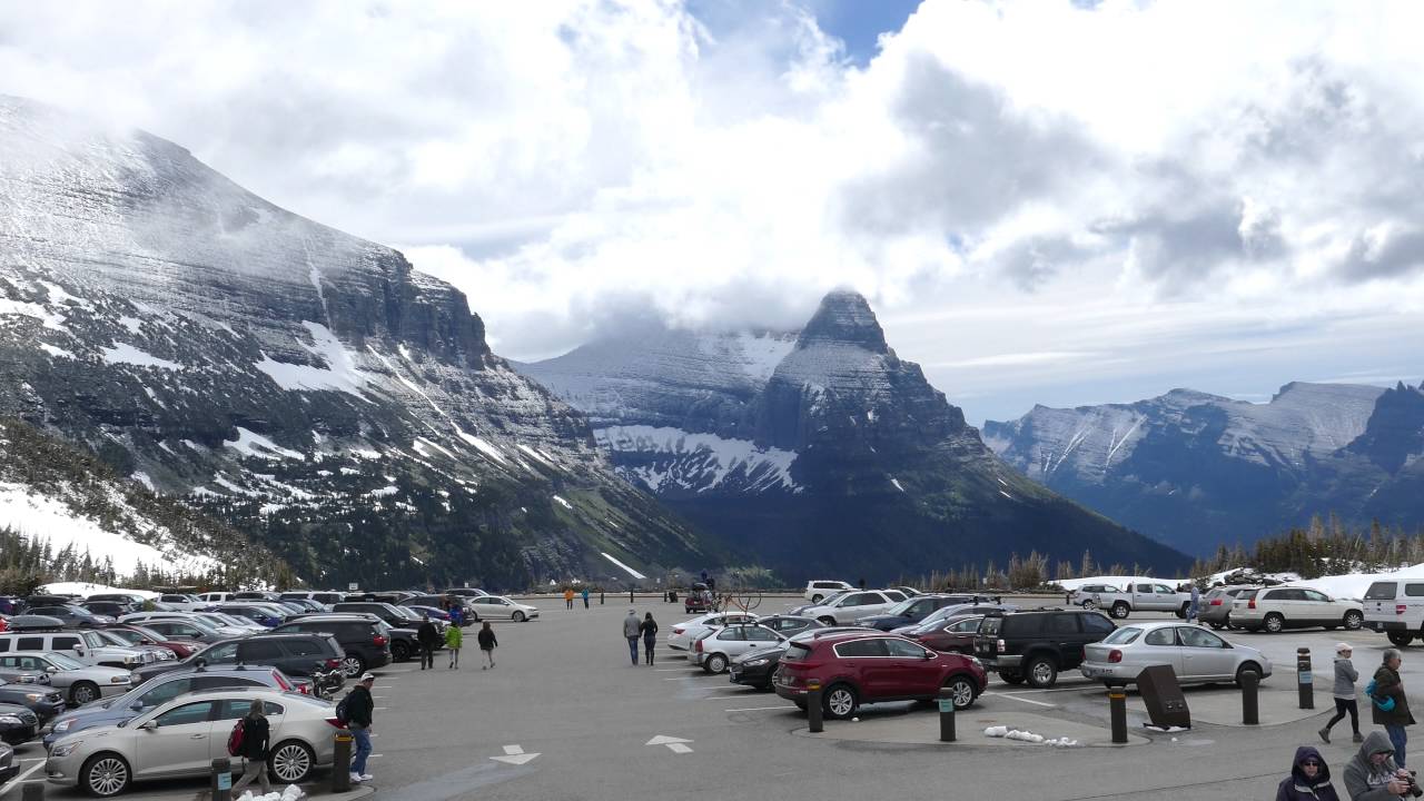
All 50 miles of the Going-to-the-Sun Road are now open for 2016! While more snow than we had last year at this time, the snow is definitely disappearing fast. If you’re planning on hiking in the high country on such trails as the Highline, we still have some time before that melts out.

I also drove down to St. Mary Falls to see what the area looks like after last summer’s Reynolds Creek Fire. I’d not seen it since the burn and I have to say that it’s pretty amazing. The hike feels like a completely different trail. I had to stop and try and remember what it used to look like a couple of times. Three things I’m really digging after the fire has gone through are the beautiful new undergrowth, great birding, and new expansive views.

As you turn up the St. Mary River drainage in the past, you could hear the river, but barely see it. You can now see it immediately, then continually as you head up towards the falls. Through the whole hike you can see peaks all around. Really cool things. Check out the photos below for St. Mary Falls and the rest of the Logan Pass opening 2016 trip.

Overall, amazing morning getting out and driving up to the fantastic Logan Pass!

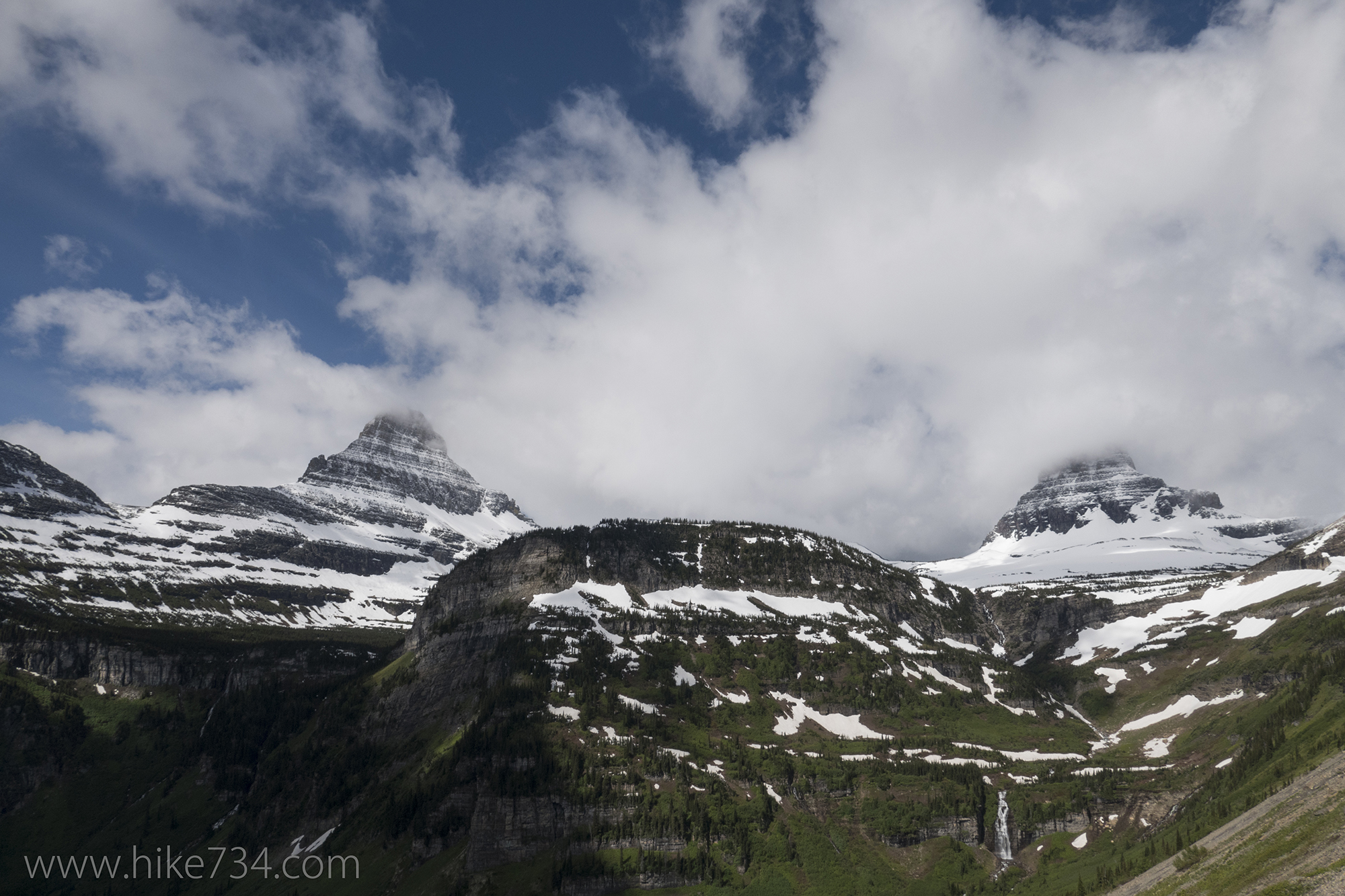
Bird Woman Falls with Mt. Cannon and Oberlin Peak

Get our sweet newsletter!

(and your free “10 Insider Tips for Glacier”)

Lists

Comments

16 responses to “Logan Pass Opening 2016”

  1. Love the pictures. We will be ther this weekend.
    Thanks,
    Sharon

    1. hike734 Avatar

      Hope you enjoy waterfalls!

  2. Thanks for the update! Outstanding photos and video. We’re really excited to see the St Mary Falls trail after the fire. Will make that a top priority when we get there.

    1. hike734 Avatar

      You should! I also noticed that they have moved the parking lot. I’ll have to update my maps for next printing. It’s just a tad east of where it used to be. Now the old parking is just for shuttle stops which is how many people will experience it.

  3. Love your Maps and blog! Thanks for making Montana easy to share with the whole world!

    1. hike734 Avatar

      You’re welcome! 😀

  4. Ron Sloan Avatar
    Ron Sloan

    Need a little help. I will be at Glacier Aug 8th – 12th with a party of six hikers. I plan on being at the permit office at about 3 am two days prior to get permits. My question is do I have a good chance of getting permits for Kintia lake – Goat Haunt, or Ptarmigan trail head to Goat Haunt for a party of six?

    1. hike734 Avatar

      It’s going to be tougher because you will need two sites. Because of your flexibility, you definitely have a better chance. Keep an eye out on the walk-in availability as you get closer. Also consider Bowman to Goat Haunt and Logan Pass to Goat Haunt. The more options with priority the better. Make sure you check out my walk-in permits blog for the details and strategy!

      1. Thanks so much. Love your videos I use them to work out on my treadmill. They make the work out much easier. I really enjoy the way you name the birds and plants. That is great. I’d love to see a directory of birds and flowers with names and locations.

        Thanks for your hikes
        Ron

        1. hike734 Avatar

          I like that idea! I’m busy making more day hike maps, but I’ll keep something like that in mind. Glad I can keep you company on your working out. 😀

  5. Did the fire burn into the Siyeh/Piegan trail head area? Thanks!

    1. hike734 Avatar

      Nope! It burned up St. Mary River, Baring Creek a bit, and Rose Creek. You can see burn maps if you look at later August ones at the fire’s incident site here: http://inciweb.nwcg.gov/incident/maps/4405/

  6. Matt and Brooke Schoonover Avatar
    Matt and Brooke Schoonover

    Hey Jake! How goes the snow melt? My daughter Brooke, and I, are traveling to Glacier next week for a backpacking trip. I would very much like to take her over Gunsight Pass but i have some concern about the snow field at the top. Friends have recommended Belly River Drainage, but we prefer high altitude lakes and views. We realize this is a challenge early but i want Brooke to have an epic first trip to Glacier. Transportation is a concern since we only have one vehicle. Any advice on a 4 to 5 day trip is most appreciated.

    thanks! -Matt and Brooke

    1. hike734 Avatar

      I have a LOT of concern about that snowfield as well! I wouldn’t plan on it. Too early still. You can ask the rangers while you’re there. I would second the Belly River. If you’re lucky, try the POI-ELF-COS route (and throw in another day at GLH with a day hike up to Stoney Indian Pass) and paid shuttle back to Many… or do it in reverse. You can get alpine with Redgap Pass and you can do a morning hike up Bear Mountain Point. You’ll need to just chat with the rangers to see what is open when you show up. Keep an eye on the trail status reports the closer you get. We’re on the cusp of more and more opening up.

    2. Matt and Brooke Avatar
      Matt and Brooke

      Hi Jake, we are halfway across Montana on our way to Glacier. Appreciate your reply and had decided to follow your discretion and not plan on Gunsight Pass. We intended to follow your recommendation on the Belly River area POI-ELF-COS-GLH either direction. That plan is no longer available and we can’t find another itinerary in that area that doesn’t have a 12 plus mile day. Plan on staying in a campground tonight and arriving backcountry office around 6 but no longer sure which area to head toward. Any thoughts.

      1. hike734 Avatar
        hike734

        Yikes! Sorry I couldn’t help you in time. (Things can get crazy around here!) What did you end up getting?

Leave a Reply

Your email address will not be published. Required fields are marked *

This site uses Akismet to reduce spam. Learn how your comment data is processed.