
Your cart is currently empty!
Search results for: “what's in our backpack”
Interactive Map – North Fork
—
by
North Fork Area Click on a trail to see the associated blog! For the best Glacier National Park map to take on the trails, purchase the topographic Hike 734 Day Hikes Map with a guide on the back (pictured below). Perfect for both day hikes and backpacking! Back to Main Map
Interactive Map – Belly River Area
—
by
Click on a trail to see the associated blog! For the best Glacier National Park map to take on the trails, purchase the topographic Hike 734 Day Hikes Map with a guide on the back (pictured below). Perfect for both day hikes and backpacking! Back to Main Map
Interactive Map – St. Mary and Many Glacier Area
—
by
Click on a trail to see the associated blog! For the best Glacier National Park map to take on the trails, purchase the topographic Hike 734 Day Hikes Map with a guide on the back (pictured below). Perfect for both day hikes and backpacking! Back to Main Map
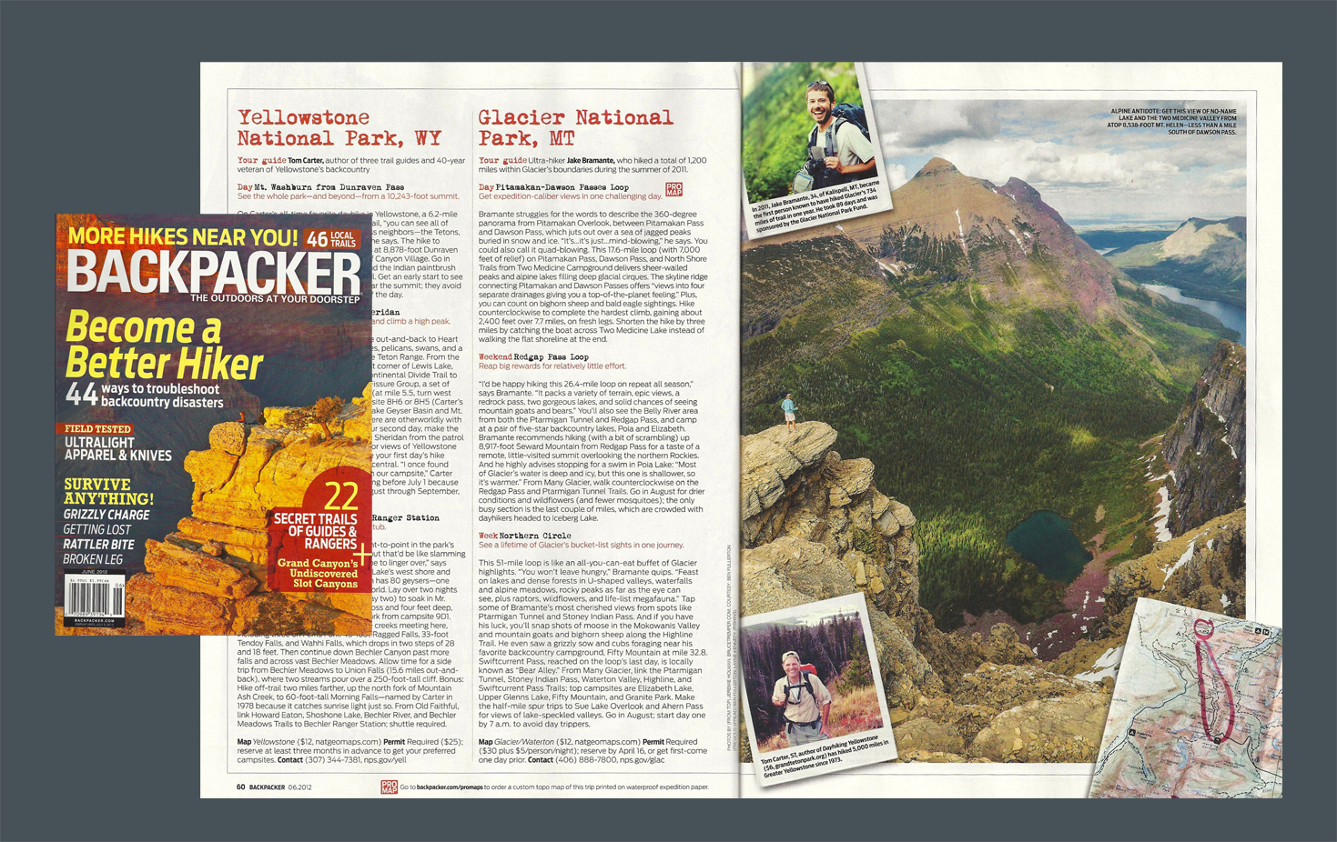
In The Press
—
by
Super excited about both having a photo of mine selected for the cover of the Glacier Gateway by the Great Falls Tribune as well as a story about my adventures with a couple more. If you have access to the Great Falls Tribune in your area, you may be able to find the Gateway at…
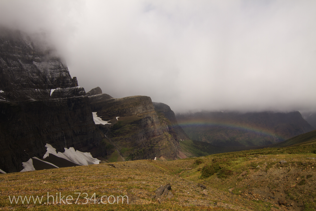
Piegan Pass
—
by
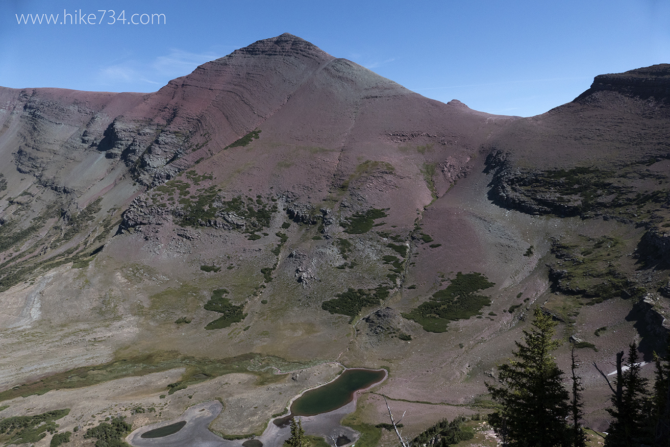
Just east of Logan Pass in Glacier National Park lies Siyeh Bend and the start of the Piegan Pass trail. On this blog, I hiked through from Many Glacier as part of an 8 day backpacking trip to my car which was waiting for me at Siyeh Bend. I had hiked it as an out…
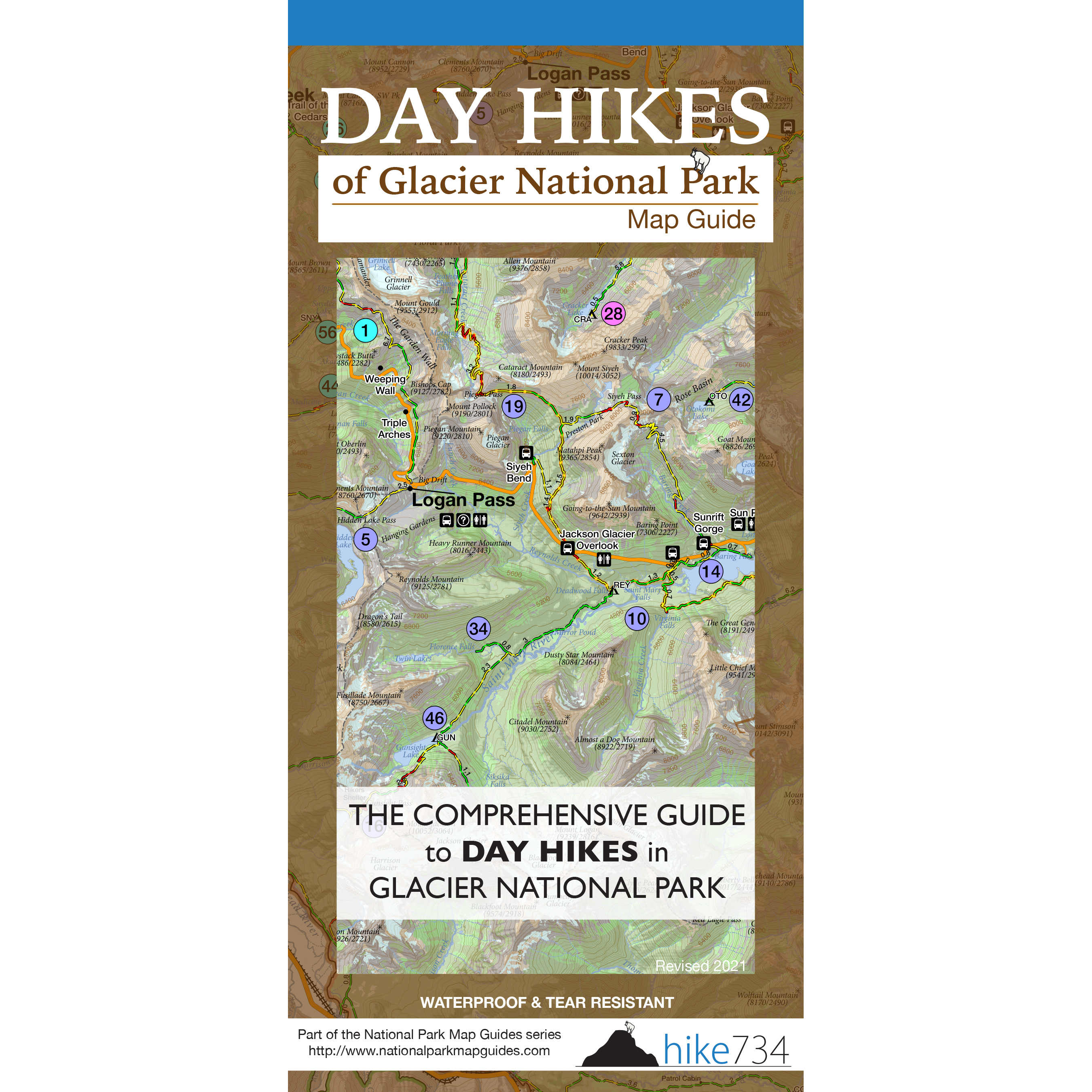
Day Hikes of Glacier National Park Map Guide
—
by
Over 100,000 sold! The Day Hikes of Glacier National Park Map Guide was designed to simply answer the question, “Where should we hike today?” These maps take the wonderful intuitiveness and visualization from a beautiful topographical map that Jake built from the ground up and couple it with short descriptions of all 88 day hikes…
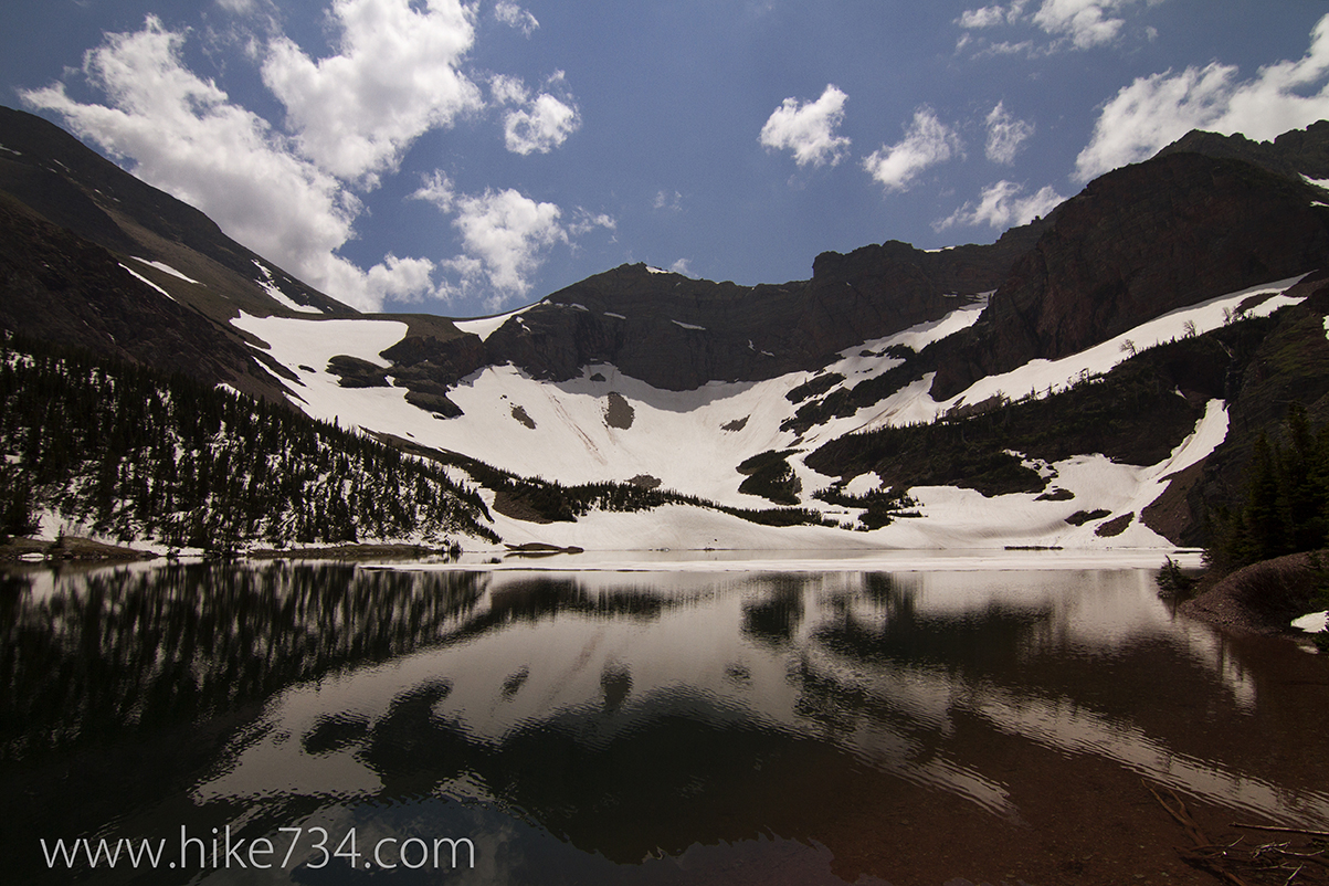
Otokomi Lake 2014
—
by
Snuck out to the St. Mary area to hike to the beautiful Otokomi Lake. The hike up bounces between Rose Creek which starts out of view, then bubbles and pools right next to the trail. As you gain elevation, Rose Creek gives way to nice views of Goat Mountain. Once again the birds were singing…
Ptarmigan Tunnel to Redgap Pass Goat Traverse
—
by
The iconic Ptarmigan Tunnel in Many Glacier is a popular day hike. The tunnel is also frequently used by backpackers descending and ascending into the Belly River drainage which is often paired with Redgap Pass to make a loop. For those interested in connecting these two features without losing the elevation via trail, an off-trail…
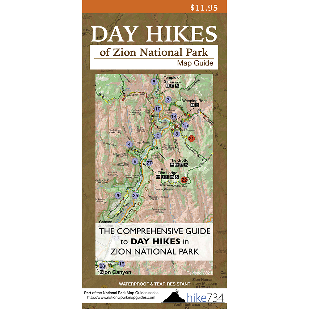
Day Hikes of Zion National Park Map Guide
—
by
New features include map extended to the edges as well as a zoomed in map of Zion Canyon! The Day Hikes of Zion National Park Map Guide was designed to simply answer the question, “Where should we hike today?” These maps take the wonderful intuitiveness and visualization from a beautiful topographical map that Jake built from the…