
Tag: hike
-
The hard decision to turn back
Just recently, we were elated to hear of the rescue of a couple of hikers that spent a few days in the backcountry of Glacier National Park. In the official press release here, the NPS commended them for realizing their predicament and hunkering down to get discovered. A local photographer and outdoor enthusiast Tony Bynum…
-
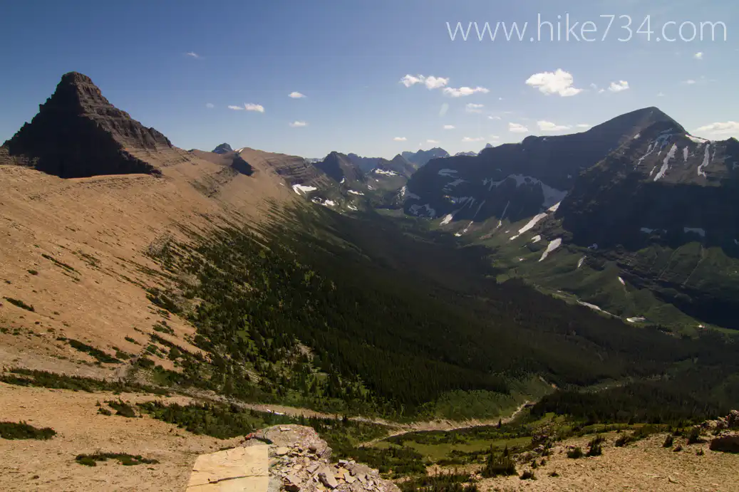
Swiftcurrent Pass and Lookout Revisited – August 2012
When I went to hike up to Swiftcurrent Lookout as part of my project to hike all 734 miles of trail in Glacier National Park in the summer of 2011, I had the misfortune of having bad weather so I didn’t get to catch it in all of its majesty. In my blog, I said…
-
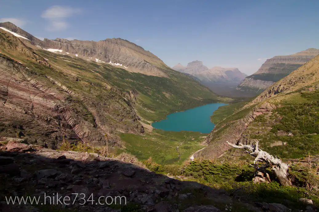
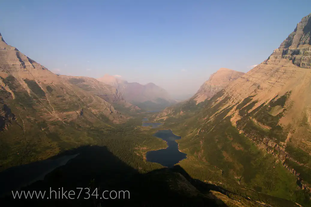
Gunsight Pass – August 2012
During the official Hike 734 project, I had a great two days over Gunsight Pass in Glacier National Park with Gunsight Lake, Lake Ellen Wilson, Sperry Chalet and Sperry Glacier to name a few things. Two regrets I had was not filming Gunsight Lake at the foot of the lake from the campground and getting…
-
North of the 49th
Well I’m heading up north tomorrow to hike trails in Waterton Lakes National Park for the next couple of weeks. Won’t be getting out much in the way of blogs, but you can track my hiking on the Track Page. Also, follow me on Twitter and Instagram if you do both of those with the…
-
Siyeh Pass – August 2012
During my presentation/fundraiser for the Glacier National Park Fund, some folks won a hike with me of their choice. They chose Siyeh Pass and what a great hike on a perfect day! We got to see wildflowers, goats, sheep, birds, etc. Check out my full hike review of Siyeh Pass here!
-
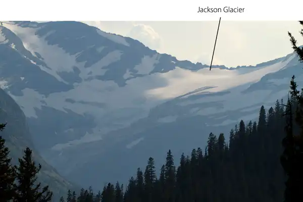
Glaciers Visible from Going-to-the-Sun Road
With a name like Glacier National Park, one would expect to show up and see a ton of glaciers everywhere. The truth of the matter is a little more complicated. For starters, the park is so named for the way that it was formed as giant glaciers carved out the peaks leaving amazing mountain formations…
-
Waterton Lakes National Park Announcement
As a follow up to last year’s project of hiking all the trails in Glacier National Park, Jake Bramante is heading out to hike the much less ambitious 125 miles of trails in Waterton Lakes National Park in the month of September, 2012. Glacier National Park and Waterton Lakes National Park come together to form…
-
Lincoln Lake
Right off of Going to the Sun Road next to Lake McDonald in Glacier National Park, Lincoln Lake trailhead starts and heads up Snyder Ridge in a hurry. It doesn’t offer much in views except little pockets where you’ll get small views of the lake or some surrounding mountains. It starts out in the characteristic…
-
Mineral Creek Cabin
In the early days of Glacier National Park, there were two trails that went up McDonald Creek around Flattop Mountain from Packer’s Roost. One went up McDonald Creek towards Trapper Creek and joined the Northern Highline by the Fifty Mountain Campground while the other went up Mineral Creek, passed a cabin and joined the Northern…