Lion Lake Number 1 – 13.3mi / 21.3km
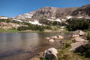
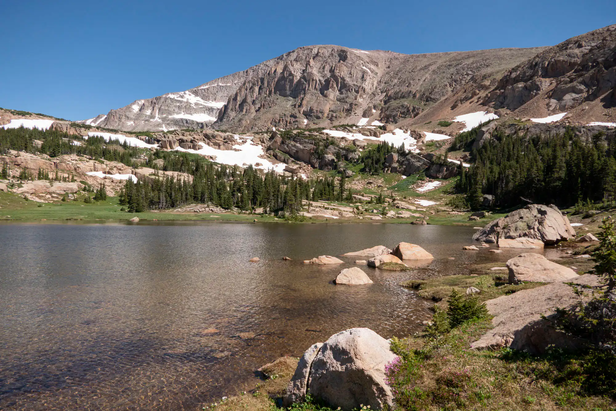
Chiefs Head Peak overlooks this lesser-visited gem of a lake fed by a waterfall, and surrounded by flowering meadows dotted with large boulders.
The trail easily cruises through the bottom of the Wild Basin valley through alternating stands of evergreens and aspen. It doesn’t take long to come alongside North Saint Vrain Creek near Copeland Falls. Follow the side-trail to the left to come alongside the creek and witness the falls. Continuing on the side-trail brings you back to the main trail.
You’ll continue to observe the wonderful cascades of the creek as you work your way up the drainage. Before the trail crosses the creek, take a right at the junction which lists four campsites. You give up the easy walking for a bit of a climb, briefly leaving the creek, then rejoining it as you continue up through the forest.
Follow the signs for Thunder Lake as you begin a steady march up the hillside with occasional glimpses of the wooded valley below. Take a right at the sign for Lion Lake Number 1 where the trail gets ridiculously steep for a bit before leveling off. Elevation comes in short, steep sections as the views increase.
As you approach the lake, rounded Chiefs Head Peak comes into view with its crumbling gray cliffs. Numerous rocky ponds appear and disappear to your left until you drop down to the lake. A waterfall cascades over peach-colored boulders, and a flowering meadow rings the lake. Find a nice rock to enjoy a snack, being careful to avoid treading on the sensitive vegetation.
On the way back, follow the signs for Ouzel Falls for two more waterfalls and a change of scenery (see Ouzel Falls for description).
Trailhead: From Colorado Hwy 7, just north of Allenspark, turn onto Wild Basin Road. The Wild Basin Ranger Station and trailhead is 2.2mi/3.5km past the entrance station.
Elevation Gain: 2,800ft / 840m – Elevation Loss: 2,800ft / 840m