
Your cart is currently empty!
Search results for: “trail to the cedars”
Shady Lane Nature Trail
—
by
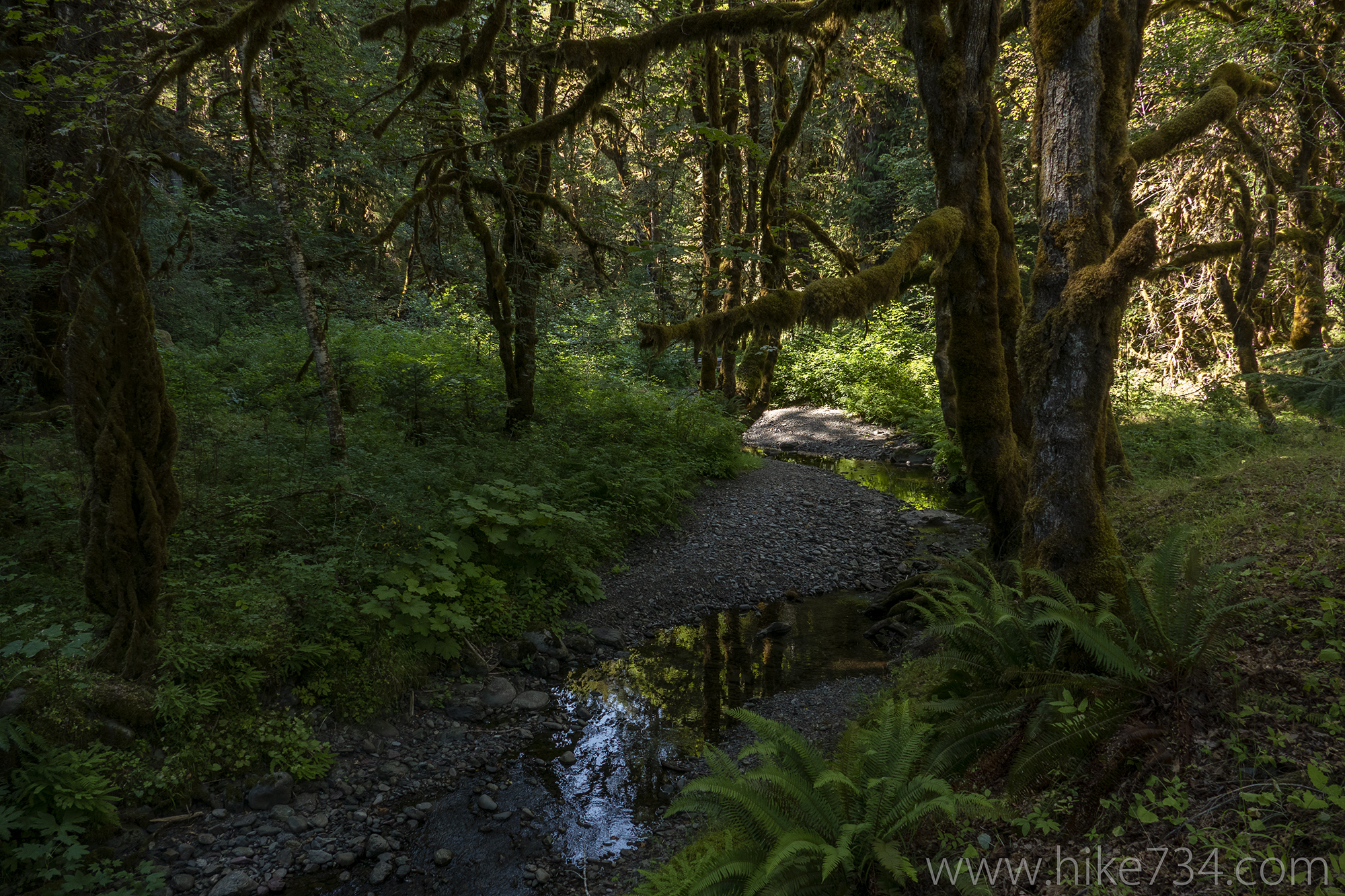
Shady Lane Nature Trail – 1.4mi / 2.3km This easy trail explores along the North Fork Skokomish River and the surrounding bottomlands. After crossing over the bridge, take an immediate left at the sign to follow the river downstream. You’ll travel along the river where campers frequently play in the water. After crossing Elk Creek,…
Apgar Lookout Spring 2024
—
by
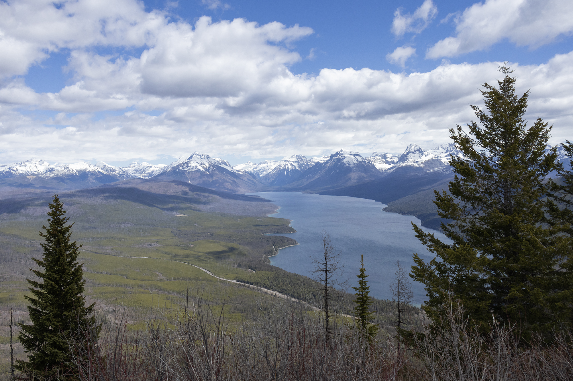
With the trail being on a south-facing slope, Apgar Lookout is the easiest way to get some elevation in Glacier National Park in the spring. The forecast called for a bluebird day, so we packed our lunches and hit the trail for a lovely spring warmup. Even if Going-to-the-Sun Road was open all the way…
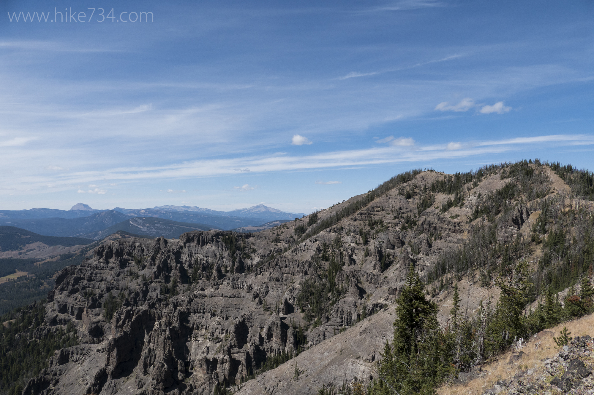
Mt. Washburn and Seven Mile Hole
—
by
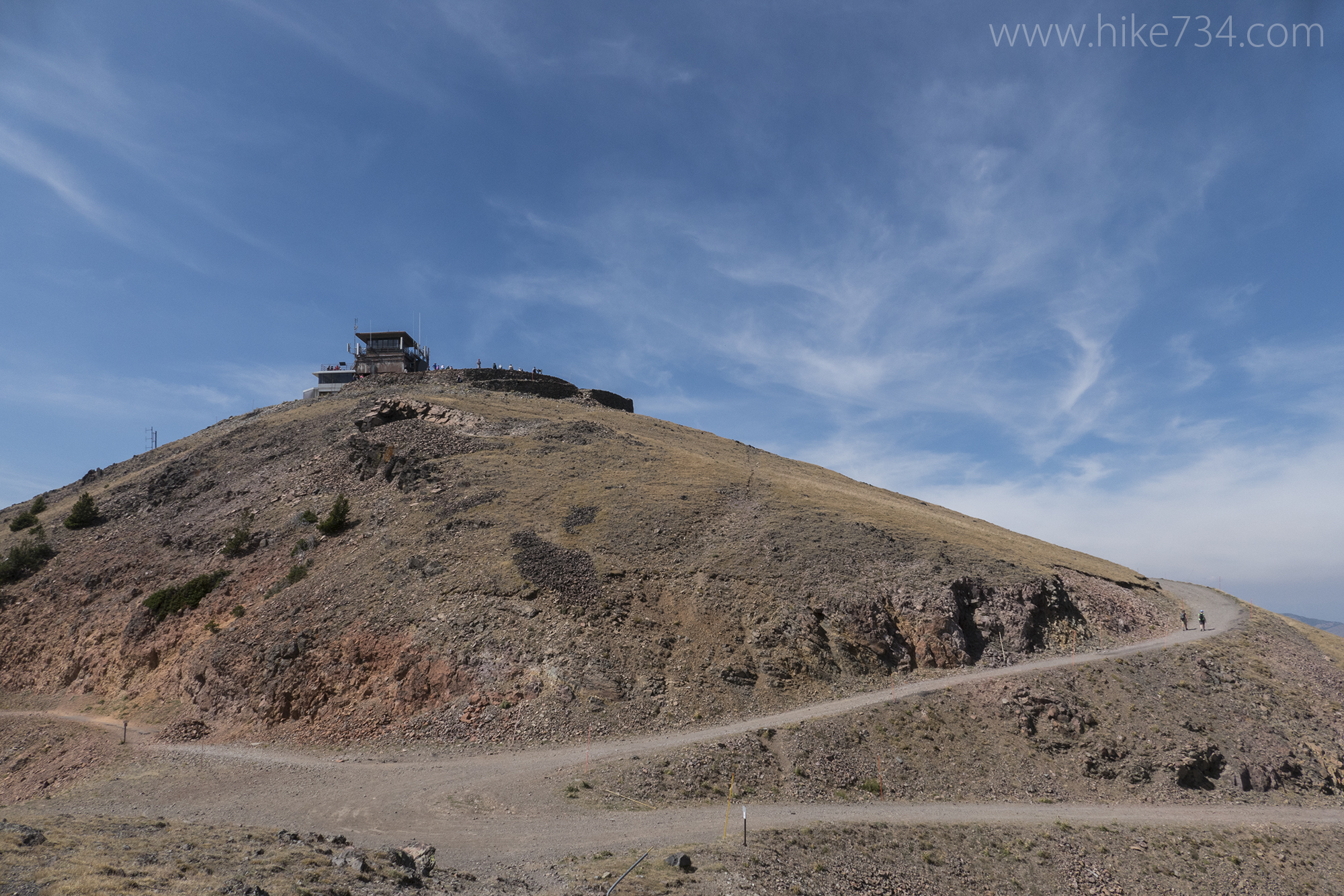
The trail from Dunraven Pass up to the lookout on Mt. Washburn in Yellowstone National Park is a vista paradise as it travels through open meadows, airy forests, and rocky slopes. From the lookout, a trail heads east on a ridge and steeply drops to the rim of the Grand Canyon of the Yellowstone, past…
National Park Map Guides
—
by
If you’re like me, when you get to a new National Park, it’s a bit overwhelming. Unfamiliar places, unexplored trails, and a bunch of names that have little meaning to you. After hiking every mile of trail in Glacier National Park in 2011, I had people emailing me asking me for advice. I would help them out,…
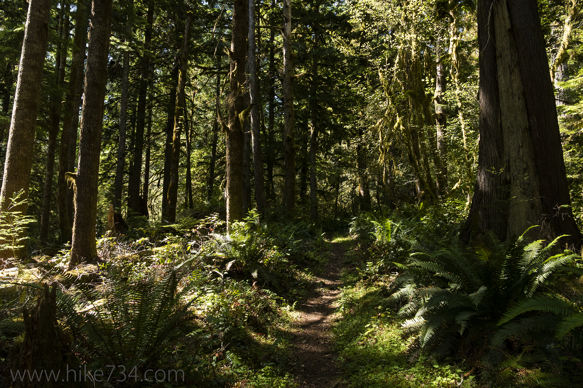
Fairholme Campground Trail
—
by
Fairholme Campground Trail – 0.8mi / 1.3km This quiet, forested loop is a nice option for those staying in the Fairholme Campground. The trail begins in the B Loop of the campground, crosses the road, and enters the forest. You’ll encounter a variety of fauna as you pass through a forest of large Douglas fir…
Sky Rim Trail via Dailey Creek
—
by
Sky Rim Trail via Dailey Creek – 18.5mi / 29.8km This hike goes up a beautiful drainage, then follows an amazing ridgeline giving you unparalleled views of the Gallatin Range, with a few bonus petrified trees to round out an epic loop. The Dailey Creek Trail starts its way across broad, grassy meadows bordered by forest…
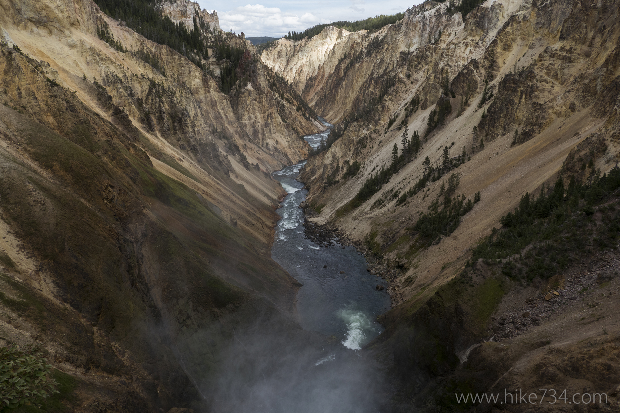
North Rim Trail
—
by
North Rim Trail – 6.8mi / 10.9km This trail follows the beautiful north rim of the Grand Canyon of the Yellowstone, and offers a few side trails to overlooks and the brinks of the two main falls. The trail starts at the north side of the Chittenden Bridge where it follows the river downstream. The walking…
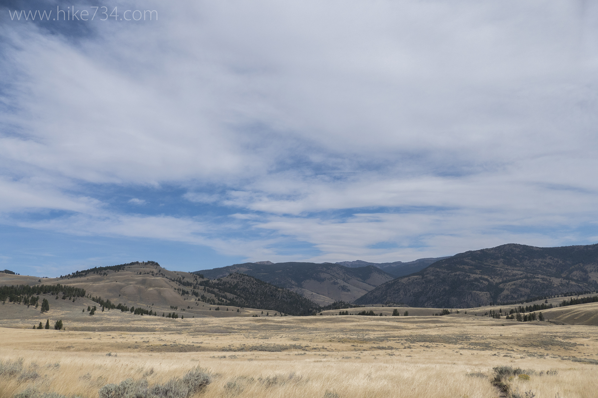
Blacktail Deer Creek Trail
—
by
Blacktail Deer Creek runs through the northern range of Yellowstone National Park. This area features sprawling meadows full of grass, sagebrush, and ponds. It’s perfect habitat for a wide variety of the park’s wildlife. The Blacktail Creek Trail follows the creek across meadows, then down as it cuts through layers of rock to the Yellowstone River.…
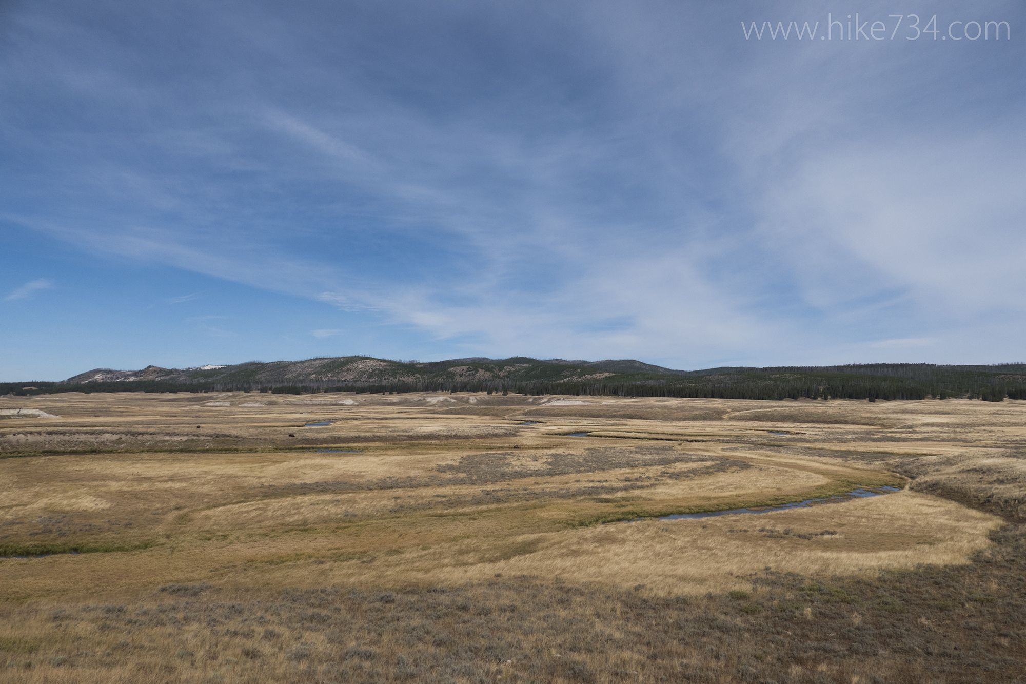
Pelican Valley Loop
—
by
The Pelican Valley Loop gives you a tour of the enormous, grass expanse of a valley that is the Pelican Valley in Yellowstone National Park. With the slow moving Pelican Creek lazily winding through it’s heart and grasslands surrounding its banks, it’s a perfect habitat for birds, bison, and many other animals large and small.…