Climbing Mt. Siyeh

Mt. Siyeh is one of six summits in Glacier National Park that is over 10,000 ft. It is the easiest of the 10,000 ft peaks to reach and has fantastic views all the way around!

A big shout out to Blake Passmore and his Climb Glacier National Park books which are incredibly helpful in finding routes to summits. If you are planning on climbing anything in Glacier National Park, check out his books at his Climb Glacier site.

It was another beautiful, bluebird Sunday when we took off from a very windy Siyeh Bend. We hiked up the trail toward Siyeh Pass through the trees, creeks and mountain flowers. Once we popped out into the meadows at the junction and heading into Preston Park, we were overwhelmed by the flowers. Thankfully the wind, while still blowing, had died down a little.

The more popular climbing route on the south face has you going up the creek bed with the biggest scree runout. We decided to go up a slightly different route which I had done before, and prefer, which is up a creek bed further west where the green grows higher. It tends to have less loose rock in the creek bed.

We ascended up the grassy scree slope to the creek bed, then climbed up the terraced creek bed to the cliff wall. From there, we worked our way east along the base of the wall to a nice chute up to the long, broad scree slope. If you climb this, at first, you feel like you are almost there, however, you have a long scree climb ahead. It’s better to get your mind in the right mode, otherwise it can feel like forever.

As we worked our way up the scree slope, I noticed a round dark spot on the hillside and wondered if it was a bear. Sure enough, a grizzly bear was up there turning over rocks, looking for moths. After watching it for a little bit, we saw that it had a cub with it and we waited to see what it would do. At the same time, some people who we had seen earlier on the summit were coming down. They were aware of the bears and told us another one had been spotted below the red cliffs near the summit.
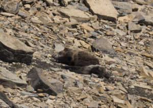
Sleeping Grizzly Bears

After figuring out the bears were going to hang out below the snowfield, we worked our way along the climbers trail to the ridge, around them. Once on the ridgeline, we kept our eyes open for the other bear and eventually saw it. It too was overturning rocks, looking for moths and being pestered by hungry ravens looking for some bugs as well. A look back down to the sow and cub found them taking a nap.

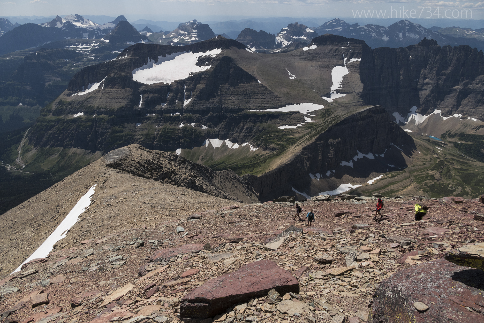
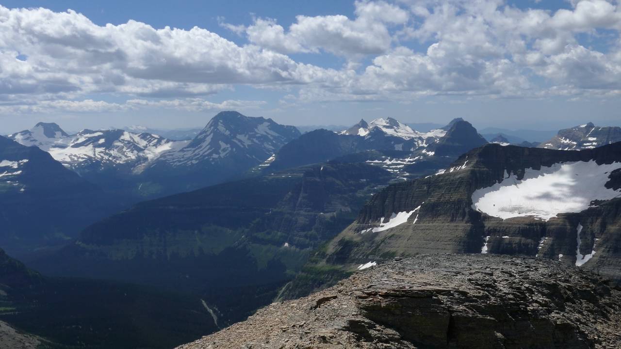
All through the cliff bands, the scree field, past the bears and onto the shoulder, the views continued to delight and get better. Glaciers were visible all around. Mt. Siyeh is located at such a great spot to look deep into Glacier National Park in all directions.

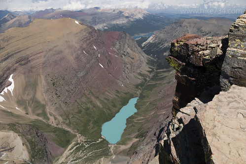
Once at the top, 360 degree views take your breath away. This summit also boasts the steepest cliff face at over 4,000 ft to the mint green Cracker Lake. You can even see up into the Grinnell Glacier basin where Upper Grinnell Lake sits perched high above the valley floor.

We ate, relaxed, took photos, then headed back down. The sow and cub were still sleeping until we got below them, then they started moving around again. We decided to take the popular creek bed down as it had a better trail and more markers. Once we hit the trail below, we cruised on down past the flower meadows, the trees, the creeks, and to our cars.

Mt. Siyeh in Glacier National Park is a sublime hike with a nice variety of climbing, a great approach, and wonderful views. We got the extra treat of some beautiful bruins along the way.

For our GPS Tracks, click here.

Looking down on Cracker Lake from Mt. Siyeh

Get our sweet newsletter!

(and your free “10 Insider Tips for Glacier”)

Lists

Comments

24 responses to “Climbing Mt. Siyeh”

  1. Mike Kinsella Avatar
    Mike Kinsella

    So how close were you at the closest to the bears? In all our hikes in Glacier, the only time we had to turn back because of bears on the trail was the Siyeh trail- we were on the way to Piegan Pass.

    PS- I won’t pan your panning this time.

    1. Hmmm, not really sure. We were closer to the solo bear because we slowly worked our way closer to it. I wanted it to see us and then see if it would move around to the north side of the mountain which it did, otherwise we would have gone low and approached the summit from the northeast side. Probably a bit under 100 yards?

  2. Harry Chandler Avatar
    Harry Chandler

    The picture of Upper Grinnell is MOST spectacular!

    1. Thanks Harry!

  3. Hans van Huijkelom Avatar
    Hans van Huijkelom

    Do you have the GPS track for this scramble?
    I’ll be in the area in September and would like to climb this mountain 🙂

    Thanks,

    Hans.

    1. Yup! The link is the last line of the blog.

  4. I’ve noticed in some trail reports/pictures some hikers used helmets, is this a must? I am planning on doing this next weekend weather permitting. Any recommendations just in general for this hike? I found your post to be very helpful as far as trail route.

    1. Jacob Bramante Avatar
      Jacob Bramante

      Helmets are a good idea… especially through the climbing sections. Glacier has a lot of loose rock so rocks falling and bouncing around is common. If you don’t have one, you just need to practice extra vigilance and make sure that you are either climbing super close or are always begin clear of each other. In regards to general advice, just make sure that you research the route, scout it while you’re approaching it, and bring bear spray. The area below the base is notorious for bears as is the top of the summit!

  5. Ben Culver Avatar
    Ben Culver

    Thanks for this useful information! Is there any difference in the difficulty level of your way up vs. Blake Passmore’s way up?

    1. Pretty negligible.

  6. How long did it take to summit? Thanks

  7. Jeff Depew Avatar
    Jeff Depew

    We had a group of 6 of us ranging from ages 10-40 and it took us around 6 hours – we spent a good 30 minutes at the top as there was no wind and we just enjoyed ourselves. We didn’t really go hard, just enjoyed the hike.

  8. Donnie Lassiter Avatar
    Donnie Lassiter

    What is the length of the hike to the summit from the parking area and what’s the total elevation gain?

    1. So my GPS said 12 miles and while there’s a little extra up and down, it’s 2,700ft difference from the car to the summit. I would recommend hiking to Firebrand Pass, then deciding whether or not you wanted to try a summit as well.

    2. It’s 11 miles round trip with an elevation gain of 4,164 feet… and most of that elevation gain is once you reach the base of the mountain. It’s a great climb, but I wouldn’t recommend it as your first climb in Glacier.

      1. Thanks for the helpful info. Couple of us are looking to hike to the summit. What’s the least techincal route? Is it the one you took or up Preston park to that big scree.

        Was the way down the same?
        Thank you

        1. hike734 Avatar

          The way to climb (not hike) it is the way through the cliffs from Preston Park. Like I said, it involves route finding and experience is important. You don’t want to be climbing down as it’s getting dark or too tired.

  9. Thanks for the post! I was the first guy up the mountain that day. Only saw the male bear, which came sliding down the snowfield behind me. I headed up to the summit, hoping the bear wouldn’t block the descent route. Great to have the bear pics, glad I didn’t know about the other bears…

  10. How does this compare to Mount Oberlin summit climb? Trying to get an idea of how much skill is needed for a climb like this. Me and 3 friends will be coming out there this fall and will climb Oberlin first to get some practice in the area and would like to do one more – either Reynolds or Siyeh probably. Does one need special climbing skills or rather just overall fitness, confidence, and no fear or heights? Thanks!

    1. Sorry for taking so long to reply. I replied on YouTube, but somehow it just ate my comment. I’m pasting what I posted over there. 😀

      My first thought is that you should do one more summit in between this one. I would recommend Mt. Reynolds or Pollock Mountain. Both are a great step up in Glacier’s style of climbing. It will give you a little bit of route finding and a little more technical without it being a sizable increase in effort and day (but still a nice step up for sure!) The climb up Siyeh definitely has exposure and climbing, but it’s more like climbing up on your countertop for much of the way through the cliff section. Once on the top of that, you think you’re almost there, but you still have another 1,000ft to go. The wonderful thing is that it’s a super rewarding climb! I would definitely go for something a bit mellower first to sharpen your skills a bit more, but sounds like you’re on your way!

      1. Hmmm…mt rynolds looks (via web) way harder? So if you where to recomend a graduation in difficulty for the novice it would be oberlin, Reynolds, Pollack then siyeh?

        1. hike734 Avatar

          I would recommend Oberlin first. Reynolds is often done next because of it’s proximity to Logan Pass, so the approach is short and it gives you some technical. The backside is less exposed, but more going up scree. The other one that would be another great early summit is going up Piegan from Lunch Creek which is one of the bends just east of Logan Pass. You’ll follow the social trail up the seasonal creek and go through the first cliff-band to the right of the waterfall. From there, head up the drainage to the wide rift in the rock and go up the rift if it’s clear of snow, otherwise, stay right and work your way up that way. From there, you’ll be at the saddle between Pollock and Piegan. Piegan is easier to get up as it’s easier to figure out. When in doubt, continue right and work your way up through the short cliff bands, then slog to the top with an excellent view looking down on Piegan Glacier.

  11. Thanks so much for taking the time to reply! I will definitely take you advice into consideration. Can’t wait to be there!

  12. Ronald Erikson Avatar
    Ronald Erikson

    Hi Jake,
    My son and I are planning on doing this the first week of September this year. Taking your advice and going to do Oberlin first though. Any other advise would be appreciated

Leave a Reply

Your email address will not be published. Required fields are marked *

This site uses Akismet to reduce spam. Learn how your comment data is processed.