
(This Throwback Thursday blog features the hike up to the top of Yosemite Falls, over to Yosemite Point, and then to Eagle Peak in Yosemite National Park that I hiked in 2017 while working on my Day Hikes of Yosemite National Park Map Guide.)
The popular, strenuous hike up to the top of Yosemite Falls in Yosemite National Park is filled with amazing vantages not only of the waterfall, but Yosemite Valley. The side trip over to Yosemite Point is a great add-on giving you different looks. Extend it further by heading along the quiet, forested trail to Eagle Peak with a panorama that will blow your mind.

I hopped on the trail at Camp 4 amongst the tall ponderosa pines and black oak and began climbing up the trail to Yosemite Falls with the waterfall nowhere in sight. The east-facing aspect was bathed in the morning sunlight, so the tree cover was welcome. Right from the get-go, the trail began to steeply switchback up through the granite.
Despite the steep trail, I was accompanied by many others as we ascended the slope. Occasional, limited views of Half Dome in the distance as well as across the valley to the Four Mile Trail were a tease of the views to come.
After a mile or so of climbing, I arrived at Columbia Rock, a slight prominence that afforded sweeping views of the valley. Mercifully, the trail ceased switchbacking as it entered into the trees first climbing up, then moderately down as it wrapped around the ridge.
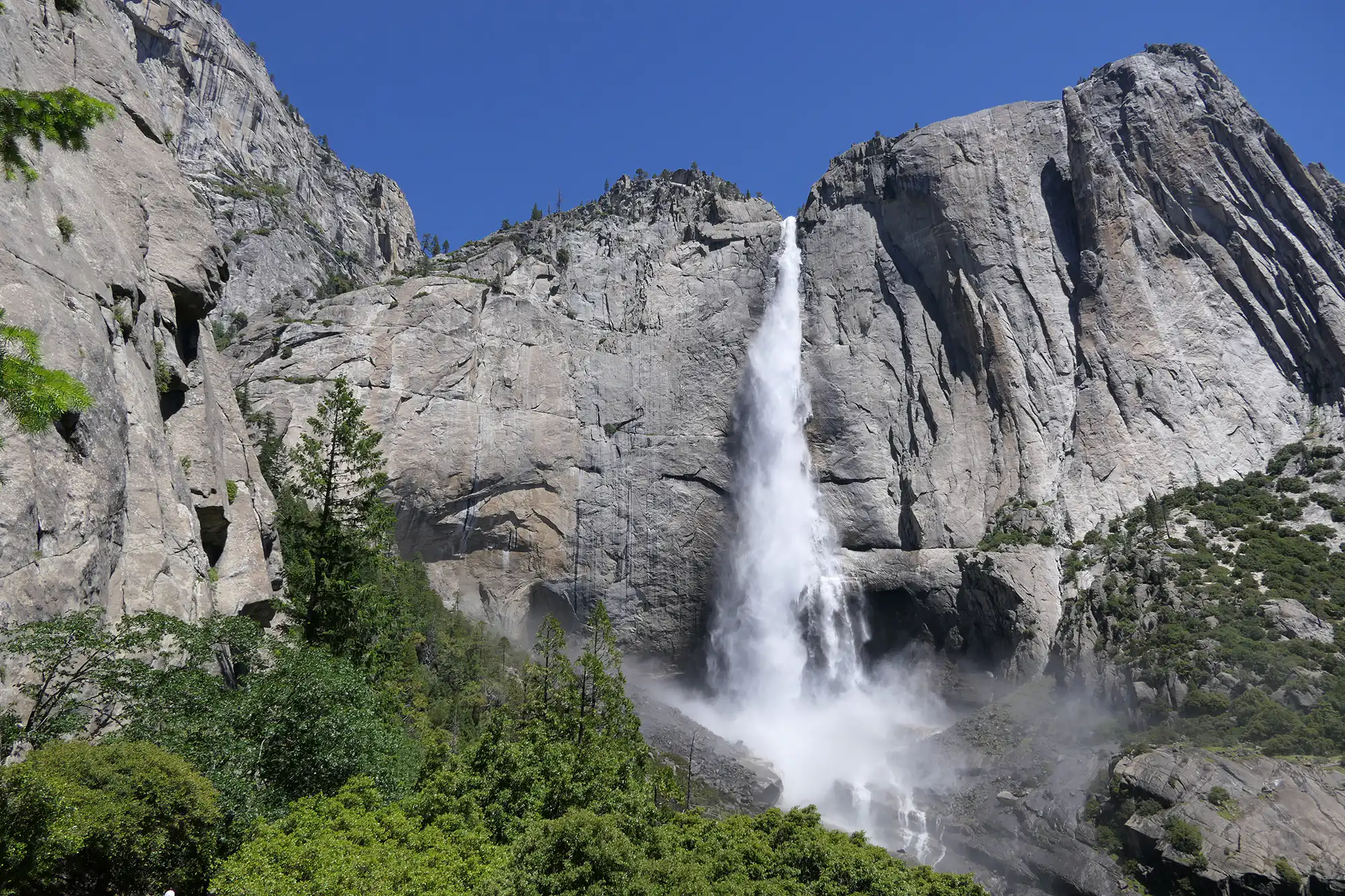
As the trail entered into the canyon, the top of Upper Yosemite Falls came into view. Dropping a little more brought me to a stunning view of the entirety of Upper Yosemite Falls where it crashed down to the Middle Cascades. I was fortunate to be here on a high snowpack year and in early summer so I was treated to a roaring waterfall.
The trail picked back up its merciless climb, as it ascended through a draw to the left of the cliff face. Massive, granite walls towered to the left as the trail wiggled up through the shrubby draw speckled with massive trees. At the top, I passed the junction for the Eagle Peak Trail (that I would take later) and took a right to head out to the top of the falls.
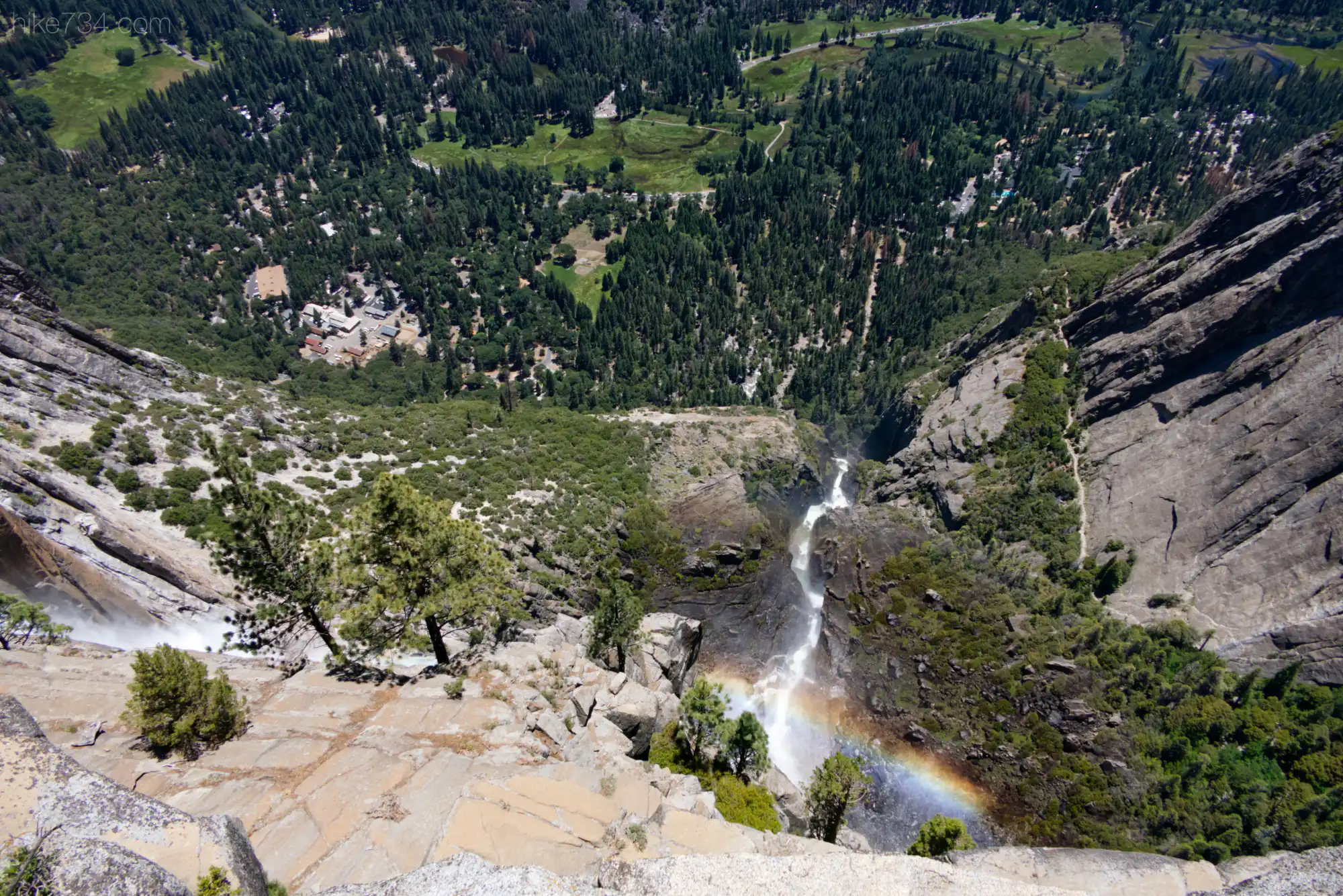
After a bit of walking through trees, the landscape changed to more bare granite and Yosemite Creek became visible below and to my left. I eventually came out to the edge of the cliff. Various narrow steps with railing embedded into the rock allowed myself and others to navigate to the edge of the creek and then out to the precipitous edge of the top of the waterfall.
With the sun to my back, around noon, a gorgeous “waterfall rainbow” was visible in the mist. The water leapt over the edge and fanned out as it crashed and tumbled down below. The valley spread out from there. The expanse, the mist, and the roar were thrilling.
After a bit of hanging out, I returned back to the trail junction and took a right and dropped down to Yosemite Creek and crossed over on a footbridge. Climbing up on the other side, one has to pay attention as the trail sometimes just quietly goes across bare granite.
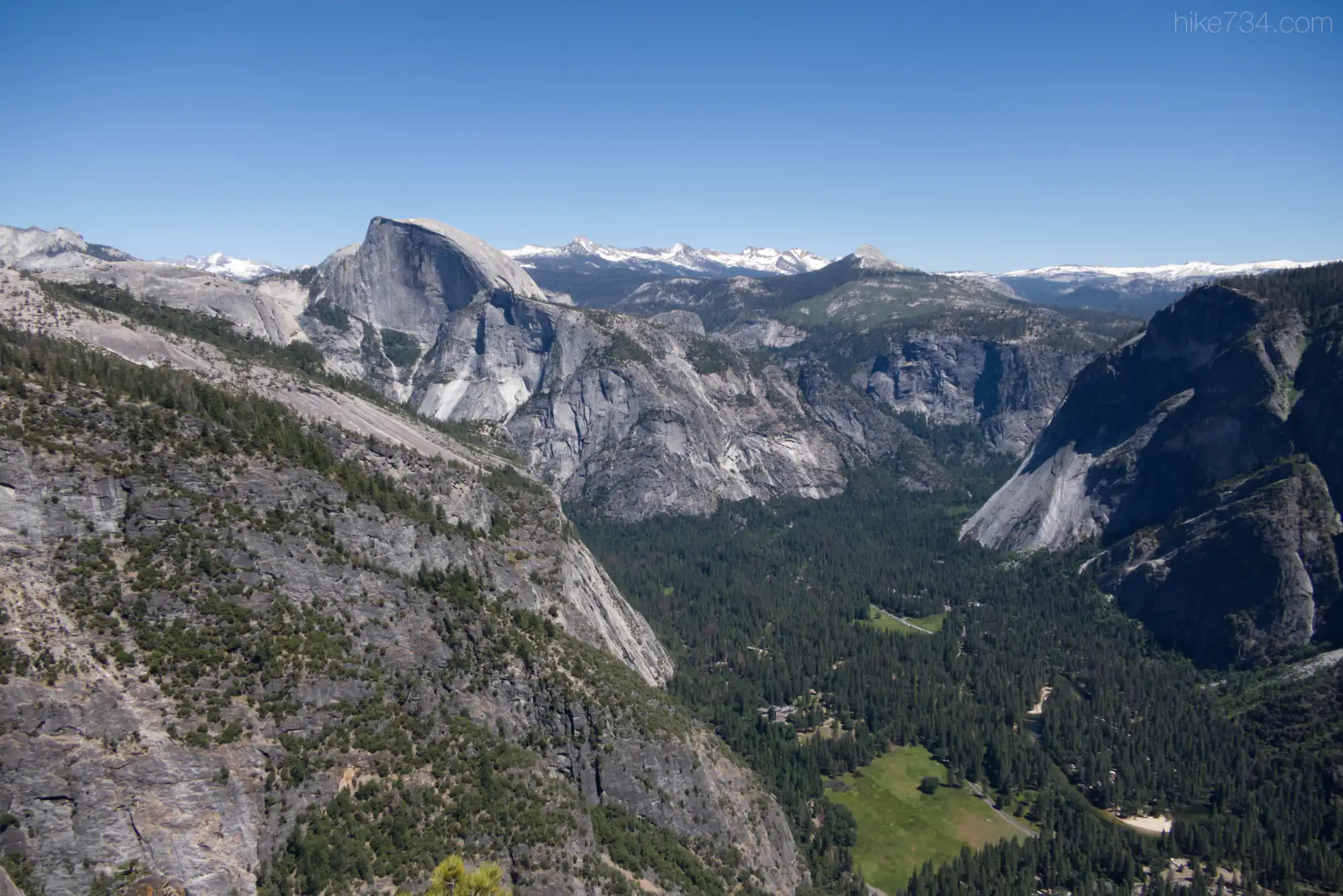
A moderate climb across granite landscapes interspersed with trees and backdropped by mountains took me out to the next amazing vantage, Yosemite Point. While Yosemite Falls isn’t really visible from this vantage, it gives you a better view of Yosemite Valley with the Merced River snaking along the valley floor. Half Dome is backdropped by other summits and other notable vantages can be seen such as Glacier Point and Sentinel Dome.
I still had quite a day left, so I turned around and crossed back over Yosemite Creek, passed the junction for the top of the falls and took a right onto the Eagle Peak Trail. This trail was much quieter as it climbed up through the trees. You could tell the park service spends more time maintaining the popular Yosemite Falls Trail as I encountered numerous downfall along the way.
I took a left at the junction to head towards El Capitan and Eagle Peak and, aside from a short, steep section the trail was fairly mellow as it wrapped around a dome. I encountered a few mosquitos as I passed through Eagle Peak Meadows as there were a few marshy areas. A Mountain Quail skittered through the understory and I enjoyed some of the early season flowers such as Snow Plant.
I arrived at my final junction for Eagle Peak and started to climb aggressively to get onto the ridgeline. My hard work was rewarded with views looking eastward. They increased as I climbed higher, culminating with the summit as I navigated through the bouldery top.
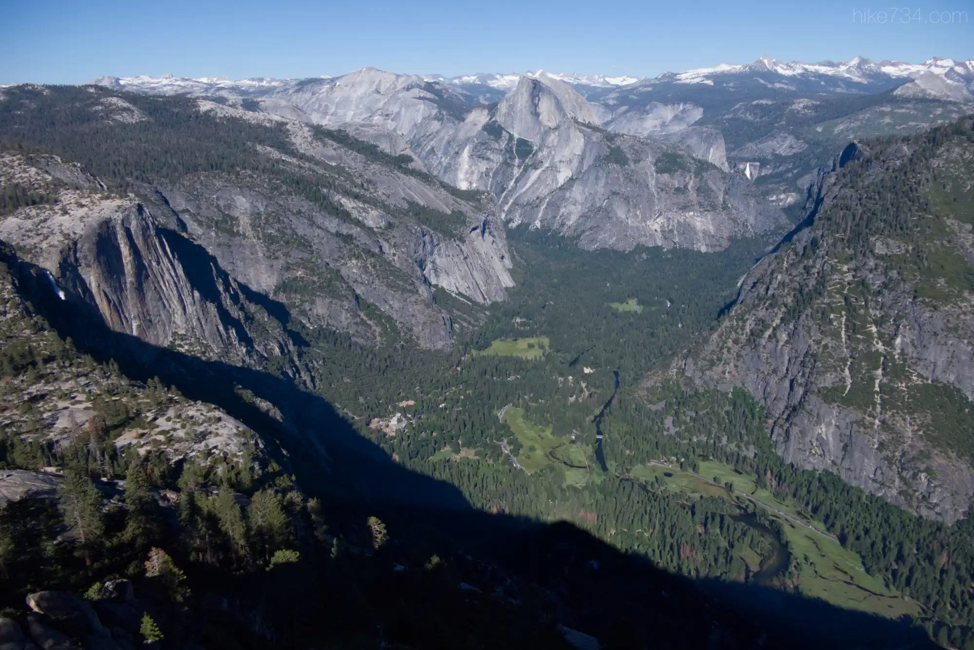
From the summit, the panoramas were incredible. This surprising vantage gave me views past Half Dome and Clouds Rest all the way to Mount Conness located in the far northeast corner of the park. Nevada Falls was visible, tucked up in the canyon that the Merced River funnels through. Of course the entire ridge housing Taft Point, Sentinel Rock, and Glacier Point was visible. An American Kestrel buzzed below me, racing along the cliffs.
The time was now around 5pm and I had about six miles left to head down, so I said goodby to the White-throated Swifts feeding above me and chattering incessantly. I descended quickly as the shadows lengthened. Big, strenuous day, but so worth every step.

Leave a Reply