
(This Throwback Thursday blog features the hike from Glacier Gorge to both Sky Pond and Andrews Glacier in Rocky Mountain National Park that I hiked in 2019 while working on my Day Hikes of Rocky Mountain National Park Map Guide.)
The trek up to Sky Pond and/or Andrews Glacier in Rocky Mountain National Park passes the lovely Alberta Falls and The Loch. Any of these locations are worthy destinations whether you’re looking for a short hike or an epic day following up icy, cascading creeks through forests to the alpine.

We started out at the Glacier Gorge Trailhead in the cool of the morning. The short hike to Alberta Falls is a popular one and we certainly weren’t alone as we dropped into the forest of pine and aspen. The lovely walk starts out alongside Tyndall Creek which playfully splashes over the boulders.
After crossing over the creek, we came to the crazy junction where we followed the signs for Alberta Falls. The trail wanders along through the forest around interesting boulders with intermittent views as it climbs. Glacier Creek comes into view and splashes down in the deep canyon. The trail also has sections right next to the creek where it pools and splits and cascades and rejoins below an aspen grove.
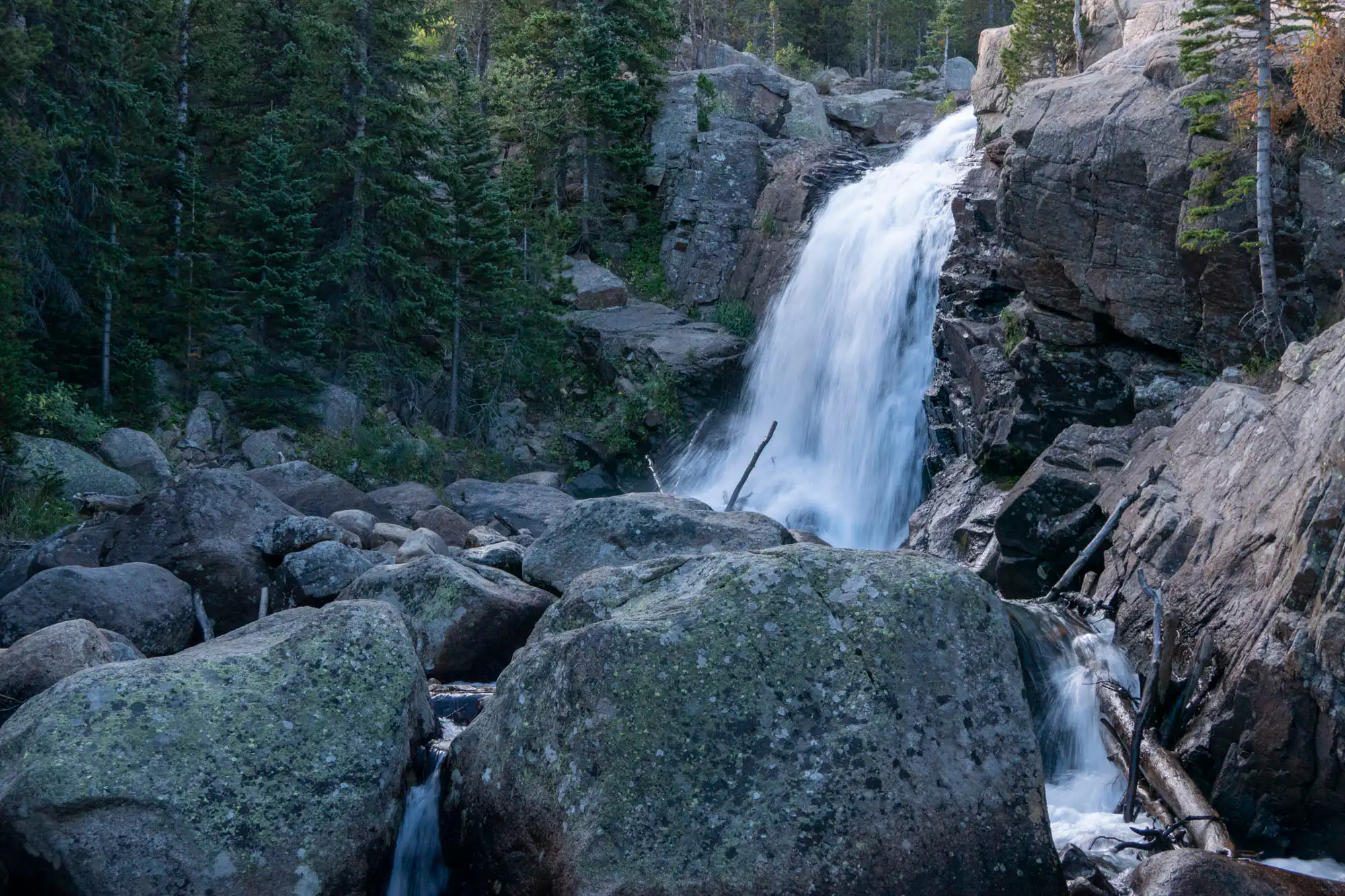
Alberta Falls was first apparent through the steady sounds of it crashing in front of us. As we approached, we could see quite a few others around the falls (but it would be much busier later in the day). We took some photos of the waterfall from below and then followed the trail to the top of the waterfall and watched it race through and spill over the edge. We had a big day ahead of us, so we paused only briefly before moving on.
From there, the trail continued to climb at a moderate pace getting closer to the Glacier Knobs and their epic, cliff-walls. At the base of these bohemith hills, the trail began wrapping around them as we passed a junction, then headed up into the cooler canyon. Glacier Creek chattered down below and the views up to the heads of the massive drainages were staggering. We noted that the willows along the creek looked “moosey” and lo and behold, we saw a cow and a calf!
After dropping down a bit, we passed another messy junction with one leading towards Glacier Gorge, but we forged ahead, officially entering into Loch Vale (or Lake Valley). The trail switchbacked up, once again, at a moderate incline, passing the lovely cascades of Icy Brook through tall canyons full of birds and flowers.
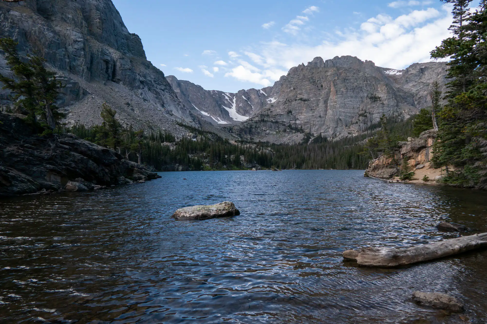
One last push and we popped out onto the shores of The Loch. This forested lake has great shore access and, while popular, has so many places to stop along the trail, that it’s easy to find a spot to relax and enjoy the view. Small islands dot the lake and the far side has imposing cliffs, permanent snowfields, and some waterfalls. At the foot of the lake, we snapped some pictures before continuing along the trail that followed along the north shore, then wrapped along the west shore to the lake’s inlet, all along with lovely views.
Once at the head of the lake, we followed Icy Brook up, once again, through the forest and meadows. More cascades, small waterfalls, and cool rock formations dotted the landscape. We crossed over Andrews Creek and passed the trail for Andrews Glacier which we’d revisit on our way back down, but we were heading up to Sky Pond first.
The trail meandered for a bit through a wet meadow containing some lovely, wet meadow, alpine flowers such as Queen’s Crowns. Up ahead, Timberline Falls was seen pouring over the headwall and the time of easy to moderate inclines were over for a bit.
The trail began stepping up and, sometimes just getting crazy as it would basically cross up a boulder field. Whenever we wanted to stop and catch our breath, we were rewarded with ever sprawling views both of the tall walls around us and the expansive looks to the east.
We (almost) reached the top of the headwall where Timberline Falls cascaded over the rocks, hopped the outlet stream and enjoyed the view. We hopped back over the small stream and followed the “route” up to climb the last section. This section was through a large boulder field and the route was a one up, one down, so everyone was taking turns as we scrambled up.
After navigating the boulder field, we were treated the the small, but lovely Lake of Glass. We followed the trail, now mostly just a route, around to the head of the lake and up to Sky Pond. The “trail” was more a collection of well placed rocks, cairns over rocky surfaces, and rows cut out of krummholtz. Wet meadows were interspersed amongst the subalpine fir and shrubbery, but the forest was now behind us as we entered into the upper stretches of the valley.
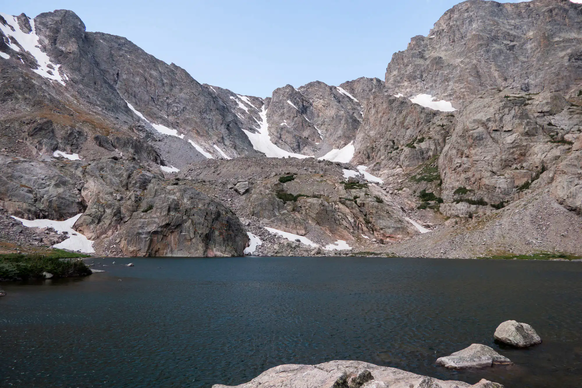
We passed a final cascade and up through another boulder field to pop out onto the rocky outcroppings overlooking the lake. Barren walls of rock and ice towered over the lovely, blue lake. Fins of rock jutted out above the crumbling landscape, tinged with a rusty orange like a crown from an ancient lord.
From there we turned around, rewinding our day, and heading back down past Lake of Glass and Timberline Falls to the junction with the Andrews Glacier trail. This trail wastes no time climbing up to the glacier as it starts fairly aggressively (well at least to our tired legs). It follows Andrews Creek for a bit before leaving it for boulder fields. These boulder fields can be tricky both in simply walking around them, but also navigating them. One must make sure to pay attention to cairns and other visual cues to stay on the trail.
Eventually, we crossed to the north side of the steeply walled canyon, then the trail gave up all mercy and just went, what felt like, straight up. We spotted a large snowfield at the head of the valley and wondered if that was actually the glacier, but we found out fairly quickly that it wasn’t as the trail skirted to the left of it.
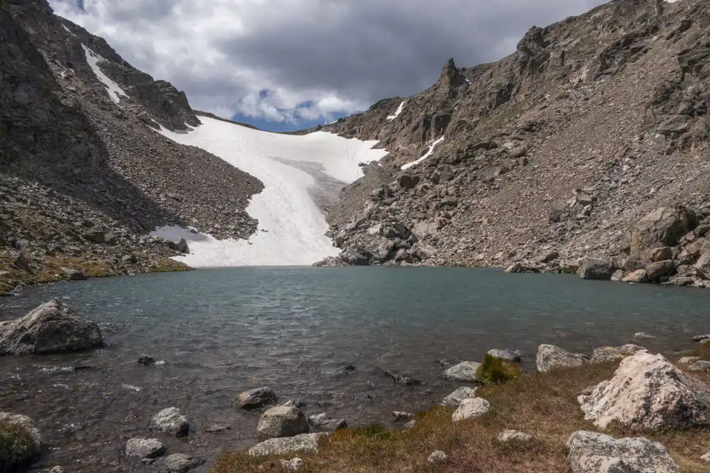
A cool canyon called The Gash opened up to our left, crowned by a great, triangular spire aptly named The Sharkstooth. After some effort , the trail crested into the basin containing both the (obvious) Andrews Glacier and the lovely, turquoise Andrews Tarn at its foot. Above the glacier we could see a sign, most likely for Andrews Pass. A popular off-trail route connects this section of trail with the Flattop Trail, but we had no intention of adding anything extra to the day.
We took some pictures, had a snack and turned around to get out of the chilly wind that whipped up over the pass, across the snowfield, and through our clothes. We steeply descended, crossed some boulder fields, traversed back through an epic canyon, passed a lovely lake, down past a waterfall, and collapsed in our vehicle with smiles on our faces.

Leave a Reply