
This blog is part of a six part series of hikes in and around the Whitefish area in coordination with Explore Whitefish. Check out their website at https://explorewhitefish.com to find out more ways to explore the area, things to do, places to stay, and how you can recreate responsibly while visiting.
One of the best things about the Jewel Basin Hiking Area is that you can drive high up in the mountains to begin hiking. From there you can climb to ridgelines with sweeping views and stop by alpine lakes nestled among the ridges. One such hike climbs up to Mt Aeneas, then continues down the back side to a pair of pretty lakes called Picnic Lakes, then loops back to your car…. oh and it’s pretty spectacular in the fall.
My buddy Dylan Boyle and I took off on a cool September day with clouds in the sky. The gravel road was super rough as it usually is in the fall, but we made it to Camp Misery.
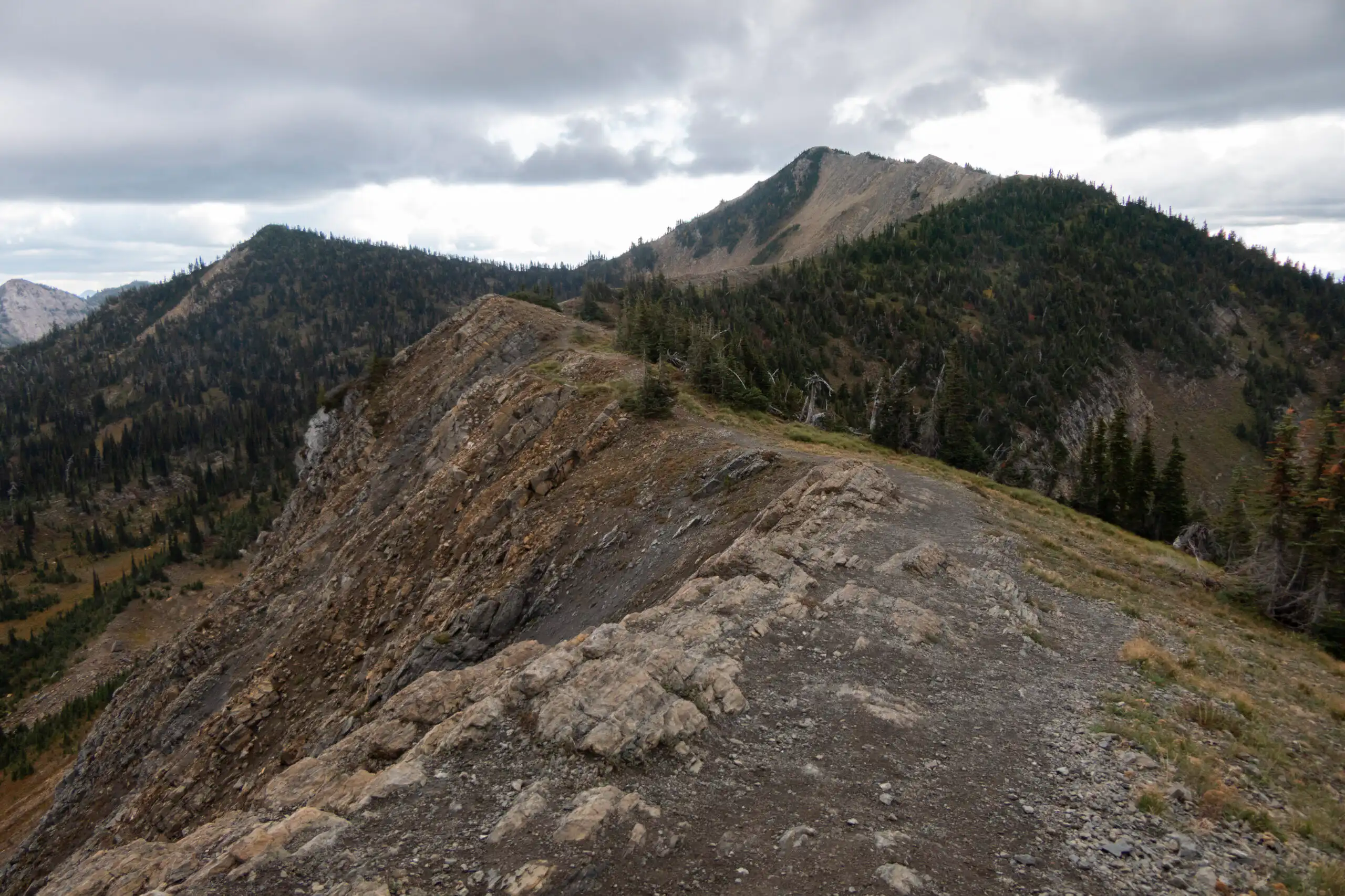
From here we took off on the Noisy Creek Notch Trail and began climbing up through the forest. To be honest, however, if I was to recommend a route to make this a proper loop, I’d recommend you go through the gate and hike up the access road. The reason for this is, is not only does it make it a loop, it also gives you some spectacular views on the way up. It joins back up at a crazy junction where the trail for Mt Aeneas takes off.
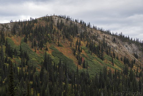
We, however did not take that route, but worked our way, switchbacking up through subalpine fir and undergrowth turning red, orange, and gold. After a bit of elevation, and some views looking across to a fall-themed calico ridge, we came to the Camp Misery Cutoff trail where we took a right. This trail continues through more of the same before coming up at the base of the ridge where talus fields have crumbled and pikas let out there “eeeeep!!!” calls.
At the junction with Alpine Trail No 7, we took a right (we return to this junction later in the loop) where the trail levels out for the most part as it shoots for a saddle.
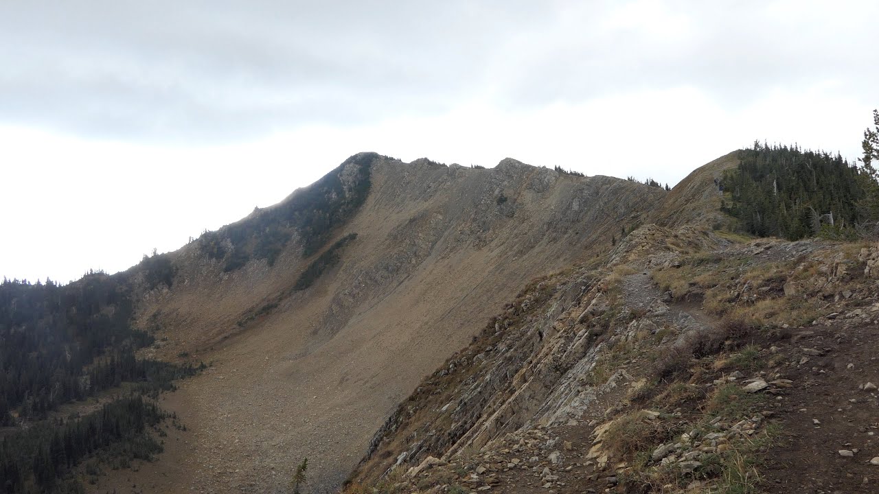
On the other side of the saddle, a confusing junction of trails splays out like spokes on a wheel. An access jeep trail takes off to the left to the microwave tower. To the right is the trail from the access road that I recommended earlier. Straight ahead, Alpine Trail No 7 heads south towards Birch Lake (another great visit). This leaves the last trail that is signed for Mt. Aeneas and we began climbing.
This section of trail quickly gives you great views. Even with foreboding gray clouds and a stiff wind, the sun was cracking through in “god-rays” down into the fields of Flathead Valley. Flathead Lake shimmered to the south and hills and mountains were visible to the west and north.
After a few switchbacks, we arrived at the ridgeline with a well-worn building (the microwave tower) and brand new views looking down at the basin, up at Mt Aeneas and out to a sea of mountains in the Bob Marshall Wilderness Complex, the Hungry Horse Reservoir area, and into Glacier National Park.
Down in the bowl below, a pair of quaint lakes lies nestled up to the ridge. Those lakes, Picnic Lakes, were our destination, after climbing Mt Aeneas.
As a side note, following the ridgeline north, past the microwave building, sat one of the Jewel Basin Hawk Watch volunteers. Every year from the end of August until the weather prohibits travel, a group of volunteers (including yours truly) get up on the ridge and count migrating raptors such as eagles, falcons, hawks, and others. You can find out more about the Jewel Basin Hawk Watch at the Flathead Audubon page.
Before we went to the lakes, however, we turned our gaze up the ridgeline to Mt. Aeneas and began our ascent. This isn’t a “mountain climb” per se, but it’s not completely a hiking trail either. If you have a fear of heights, the ridgeline might be a bit much for you, but if you don’t mind the heights (or enjoy them), this trail is super fun… and you will probably see a few mountain goats along the way (please keep your distance from them as they are wild and unpredictable).
Views upon views as we climbed and sweated to the top. Once up on top, we got a couple of drops of rain, but it spared us any wrath. Everywhere we turned, there were amazing views and it’s no wonder why this climb is popular from when the snow melts until when the road is no longer passable.
From there, we dropped down the ridgeline to the south on another “trail” where it then made a hairpin turn and headed north, traversing the eastern flanks of the mountain and headed for a saddle. Large boulders, cliffs on opposing ridges, and western anemone flowers that I like to call “hippies on a stick” (see in photos below).
At the saddle, the trail dropped into the bowl we could see from above and traveled through golden fall foliage and green subalpine fir. Where the ridge was whipping wind, the air now was still, save for the occasional call of birds or pikas. We passed a few pocket meadows before we came to an unsigned trail junction where we took a left to Picnic Lakes.
We came to the lower of the lakes first and the footbridge separating the two. Since it was fall, the connecting streambed was basically dry and we walked up it to see the upper lake and found a couple of rocks to enjoy a bite to eat. An American Dipper (small gray songbird that bounces with great regularity) sang a soft little tune on an island.
From there we headed back to the bridge and began to climb up to a saddle where we re-entered the wind and dropped down the steep ridge in a series of switchbacks. We finally got back down to the junction with the Camp Misery Cutoff Trail we were on earlier and followed it back down to our car.
Leave a Reply