
Just west of Apgar, tucked behind the Fish Creek Campground and Picnic Area, lies a short hike to a unique vantage of Lake McDonald. This short, lollipop-shaped loop takes you through both mature and recently burned forests, along creeks, and out to rocky outcroppings.
The Rocky Point Nature Trail does have a short section of elevation gain, but the reward is some wonderful views of Lake McDonald without the crowds that gather along the Going-to-the-Sun Road.
If you’re staying at the Fish Creek Campground having lunch at the picnic area, you can jump on the trail right for Rocky Point which parallels Lake McDonald. The trail can be a bit funny to find from the picnic area or at the southern end of the campground, but as long as you’re working along the lake, you’ll figure it out.
The approach from the Inside North Fork Road just past the campground’s entrance is a bit more straightforward as there is and obvious sign near a parking area off the road.
From the road, you enter into a mature, mostly lodgepole pine forest. You can hear Fern Creek just before you see it, and it should be fairly easy to spot birds flitting in this area. Huckleberries abound in mid summer, with leaves turning vibrant oranges and purples heading into fall.
Fern Creek flows into Fish Creek and the trail crosses the creek in a lovely shaded spot before climbing up on the other side. Here, a trail breaks off to the right to go into the campground, but stay left to work your way to the loop. The dynamics of forest fires are on display through this section as the trail acted as a fire break. To the left is the devastation and new growth of the fire while the older forest stands to your right.
After a short stint along this break, you get your first glimpse of Lake McDonald as the trail from the campground and picnic area join with the trail from the road. Stay left again, passing a couple of interpretive signs on the way to the loop around Rocky Point.
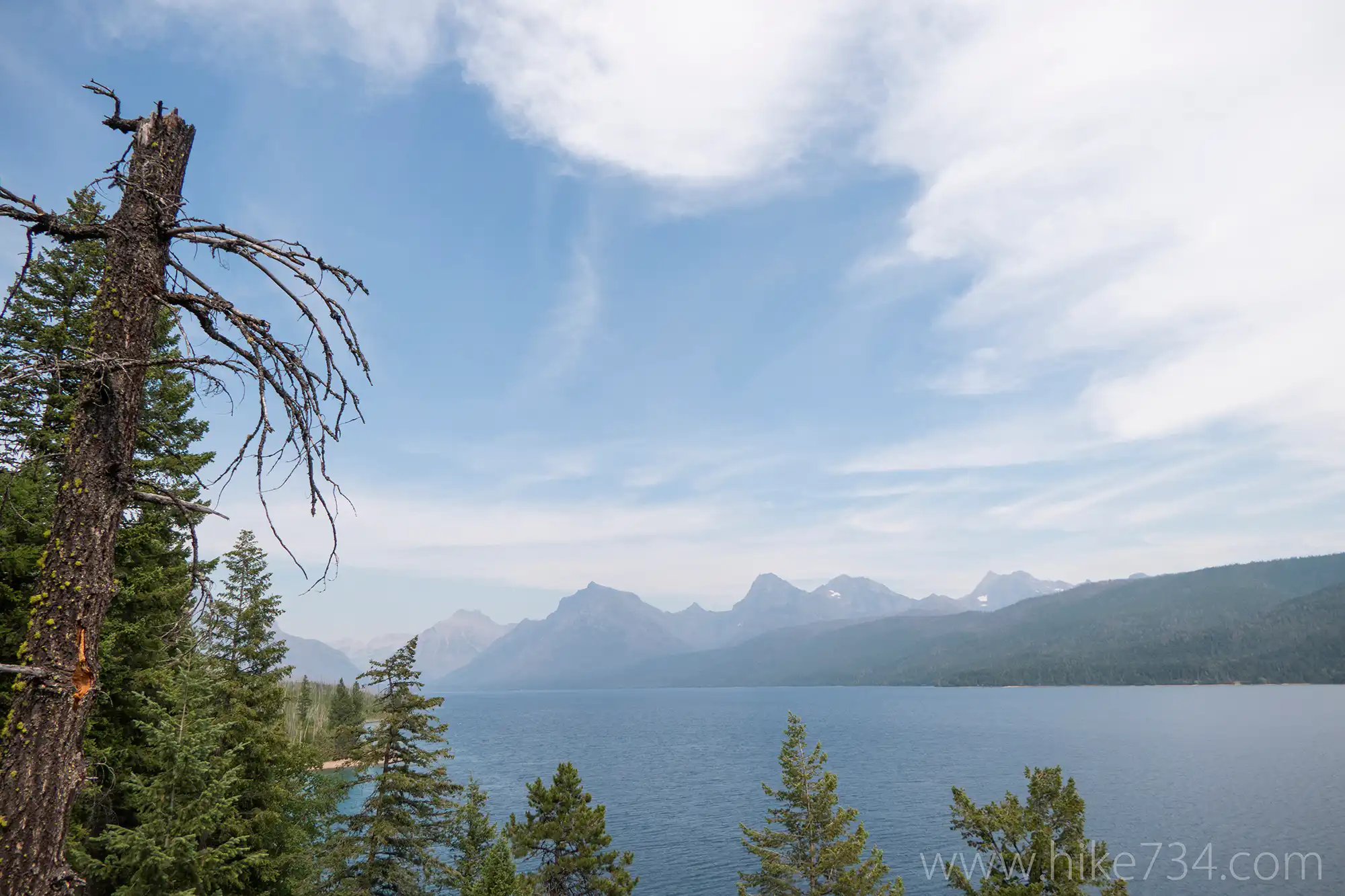
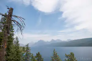
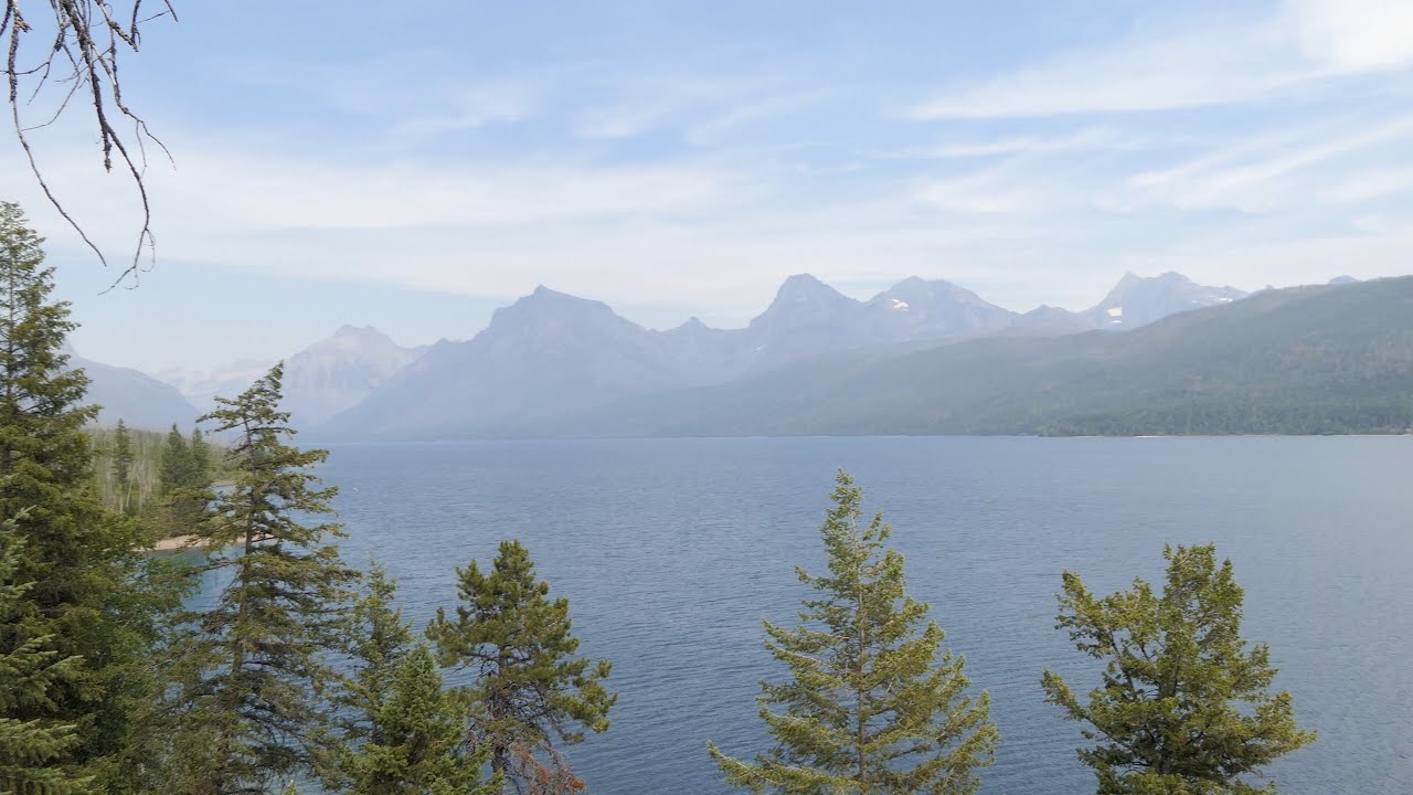
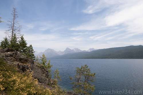
I did the loop counter-clockwise which visits the southern aspect first. You can go right down to the shoreline of Lake McDonald if you want, but the trail works its way through the older forest just up from the shoreline. Numerous social trails fan out, some staying low while others climb. All of them eventually merge as the trail sharply gains elevation and brings you out to the point. You get some wonderful vantages looking towards Apgar at the foot of the lake and up towards the iconic Glacier mountains at the head of the lake.
Check out the few vantages at the top before a last little climb that takes you up to the top and the boundary with the burn area. On the way down the northern aspect, you get more views of the lake and Howe Ridge, albeit with some gray snags partially obscuring the view.
The newer, tightly packed lodgepole pines are gradually obscuring the views as you drop down into a hall of trees and to the junction with the West Shore Lake McDonald Trail. If you have the time, you can wander down this trail for awhile with very limited access to the lake until you reach the backcountry campsite.
Stay left at the junction, however, to close up the loop as you climb back up to the ridgeline. The trail steeply descends through aspens, larches, and lodgepole back to the trail you came in on. Keep an eye out for birds through this section, especially through breeding season, before heading on back to your car.
Leave a Reply