
Alpine meadows, expansive views, a glacier, and a creek that tumbles into blue/green pools over red rocks all await on the Siyeh Pass Trail. While we like to do this hike when Preston Park is full of flowers, hiking it later in the summer yields less insects and more huckleberries.
After a little bit of hemming and hawing, we decided to hike Siyeh Pass. It feels like one of those hikes that we could do at least once a year and not tire of, well we haven’t tired of it yet. We decided to throw on our running packs again for this one and make it a faster trip to change things up.
We arrived at Siyeh Bend a bit past 9am, found a parking spot and hopped on the trail. Siyeh Creek was still chattering over the rocks and the smoke hadn’t settled in, although there was a slight haze. The fall morning was cool and we stayed warm by hiking quickly up through the trees.
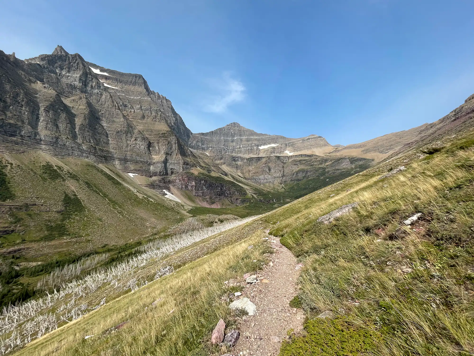
A left at the first trail junction brought us further up the valley. Pocket forest birds were singing and the pungent smells of late fall foliage were in the air. It doesn’t take too long to break out into meadows after crossing over Siyeh Creek. Piegan Mountain is unmistakeable to the west, but its glacier doesn’t become visible until you’re a bit higher up.
Meadows that used to be full of flowers earlier in the year have a few stragglers that were mostly gone to seed. One such meadow is an expansive one and gives you a great first view of the huge size of Mt. Siyeh, one of Glacier’s 10,000 footers.
At the trail junction, we took a right and headed east, up towards Siyeh Pass. As we gained elevation and into Preston Park proper, we began seeing small the small ponds that dot the area. The crossing of Siyeh Creek up here splits the upper ponds at the base of Mt. Siyeh and the lush meadows below. Early season snow still lingered from a recent storm.
The trees gave way to alpine meadows. Everywhere you turned you saw rocky summits. Piegan’s glacier was easily visible to the east with other summits along the garden wall keeping it company to the north. We turned and left the alpine meadows and entered the rocky landscape. While the snow was found in small pockets below, snow lined much of the trail, deposited by the blowing wind.
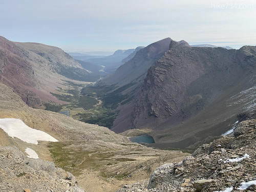
The Boulder Creek drainage began to come into view as did more red rock to serve as a sharp contrast of the grays and browns we had been seeing. More switchbacks and more wind as we climbed up the shoulder of Matahpi Peak until we eventually turned the corner and were able to look south.
The vantages into the three drainages are stunning from up here. Boulder Creek winds through meadows and trees, with red rocks scattered throughout the valley. Tarns of green water sat right below our high perch. We stopped and took it in for a second before dropping down into the Baring Creek drainage.
The morning sun was lighting up the east face of Going-to-the-Sun Mountain and the Sexton Glacier. The glacier’s moraines looked like large gravel piles on the shelf below the mountains. We started down the many switchbacks that lead to the valley floor below.
The terrain goes in revers from rocks to alpine meadows to trees with scattered meadows and down into the forest. This side is a bit drier, so the meadows are larger. Late season flowers whipped in the wind as the snow takes a bit of time to melt out in the upper reaches. A herd of bighorn sheep grazed on the still green vegetation and we navigated the ewes and lambs to get down.
Once past the headwall, looking back up is nothing short of breathtaking, especially towards the glacier. It sits perched high up on a ledge with the mountains standing guard. A triangular debris field extends all the way down to the bottom of the bowl and Baring Creek starts its gorgeous cascade down the face to St. Mary Lake.
While we ran through most of the downhill, we slowed down as we entered various patches of trees. The huckleberries were aplenty through here and we didn’t want to surprise a bear or have it surprise us. Through the wide open fields however, we trotted on down. Mountain Bluebirds and American Robins flew around as they feasted on the berries and caterpillars.
A few years ago, a fire came up this drainage, creating a forest of silver ghosts. The trail switchbacked through the old subalpine fir forest and then dropped us right next to the creek. Here, the water was exquisite cascading from pool to pool, splitting, then rejoining. The riverbed is brilliant red rock and worth the trip in and of itself.
We took a few pictures and spent a few moments to soak it all in, before following the cascading water down. One more forest of silver trees, these much taller, whistled as the wind blew over knot holes in the wood like an empty bottle. The smoke was getting worse as we arrived at Sunrift Gorge where the creek makes a 90 degree turn, then swirls around and under the road before cascading at Baring Falls into St. Mary Lake.
At the road, we walked over to the shuttle stop and made our way back to our car with another one in the books.
Leave a Reply