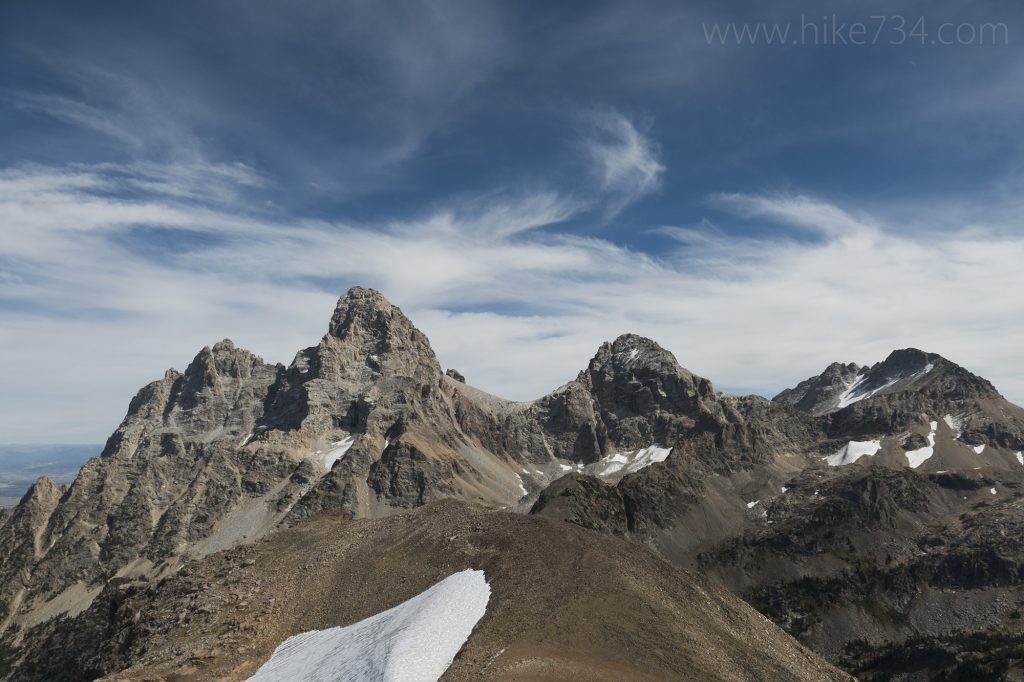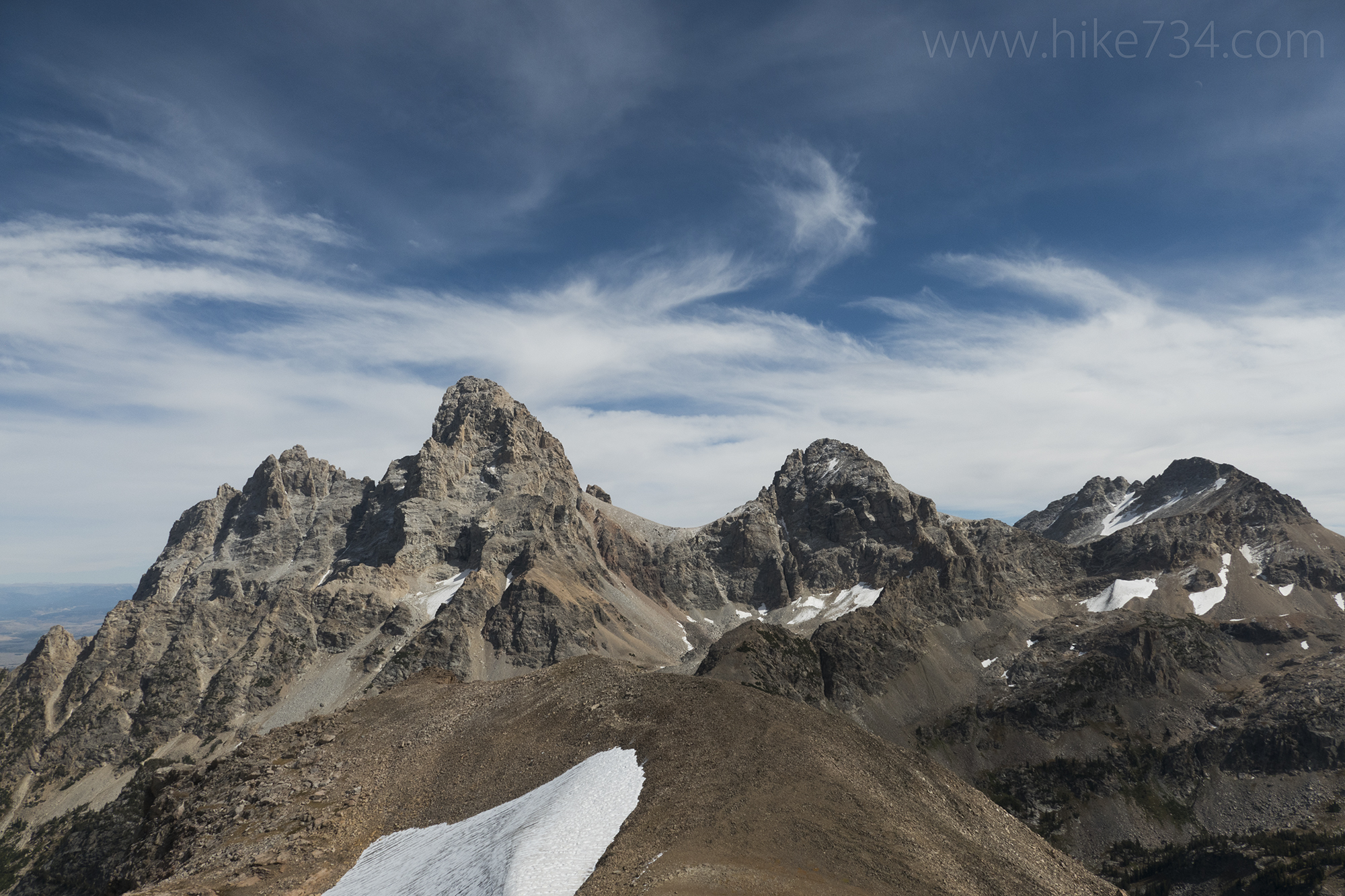
Table Mountain boasts incredible views of the Grand Tetons. It’s summit sits on the boundary of the Jedediah Smith Wilderness and Grand Teton National Park, but the trail itself comes in from the Idaho side and is entirely in the Jedediah Smith Wilderness area.
Regardless, for fans of Grand Teton National Park, it’s a hike up a beautiful drainage to breathtaking views.
It takes a bit of driving from Driggs, ID to get to this big hike and we wanted to get an early start, so we stayed at the Teton Canyon Campground in the National Forest and woke up on a crisp, September morning. The fall colors carpeted the area with golden grasses and pops of maroon.
There are two routes to get up to Table Mountain. A popular route is an insanely steep trail called the Face Trail 029 which starts a little bit further up the road from the campground. We ended up dropping back down on that trail just to see what it was like and I don’t recommend coming down it at all. It makes for a shorter ascent by cutting out 2.6 miles vs the route up North Fork Teton Creek and plenty of people were doing it that way.
The other way to go up, and definitely the way to come back down, is the longer, gradual trail that goes up the North Fork Teton Creek drainage.
While it’s not as steep as the Face Trail, it starts pretty aggressively as it gains 400 feet through an older forest. It was a great warmup on the chilly morning and took us through stands of aspens and pine trees and up into gorgeous meadows. The area is an interesting collection of jagged spires along the ridgeline, and striated hillsides further to the west.
The trail alternates between meadows and patches of forest as it gradually works up. The views kept getting better as we worked our way up. The creek playfully cascaded below us and we could see it occasionally.
Eventually, we crossed over the creek and onto the north-facing slopes with an older forest with larger trees and wrapped around into a bowl. Table Mountain became more visible and seemed close, but still far away. The trail switchbacks up the face of the bowl, passing through perfect American Pika habitat which is always a treat to see.
After a bit of switchbacking, traversing, switchbacking, catching our breath, and ever expanding views, we reached the ridgeline. A really cool traverse on a shelf brought us to the meadows, the junction with the Face Trail from below, and the long slog up to the summit.
While it seems like we were close, we still had almost 1.5 miles left to go. While the east face of Table Mountain is a jagged, cliffy affair, from the west side, you can really see how it is simply a long meadow being uplifted to becoming a mountain.
The terrain here is mostly open meadows with sprawling views looking everywhere. Some brief patches of trees interrupt the views, but we quickly left all of them behind. The hike is more difficult than it appears and we were happy to stop and soak in the views.
One stretch of trail passed over a wide section of shale. The footing was fairly tricky, but it was a really interesting , then the trail resumed the hard, dirt walking through meadows. It gradually got steeper as we approached the actual summit.
A cliff band rings the summit which you have to navigate, but is fairly straightforward. It was just one more bonus that makes this a delightful, but challenging day. Once on top, however, the payoff exceeds the effort.
From the top, we were treated to sprawling views of the rugged Teton Range. Across the gorgeous drainage of the South Fork Cascade Creek, rose the three Tetons. Grand Teton itself feels so close, flanked by summit after summit.
It’s really fun to figure out which canyons, summits, drainages, trails, etc that you’re looking at because you can see so much. Looking west into Idaho, you can see the agricultural fields and you can see the grasslands of Jackson Hole to the east. Sandwiched in the middle are the craggy features of the Teton Range that couldn’t contrast more with the surrounding flat expanses.
After soaking in the views, and getting a little chilled from the wind on the summit, we headed back down. The walk back to the junction with the Face Trail was much quicker and easier than the way up. We vacillated on whether we should go down the way that we came up, which was the preferred way, or see what the Face Trail was like because so many people had used it.
Ultimately, we opted to explore the Face Trail. It was a ridiculously steep affair and one that should be avoided for a descent. It began benign enough as it continued through open meadows, gradually working its way down. We came across a Black Bear at a distance and watched a Red-tailed Hawk soar.
Eventually, however, the trail begins it’s precipitous descent and it is in some kind of hurry to get to the bottom. With only a few brief respites on the way down, it goes from open views to forest. We were down quickly, but it wasn’t fun.
I can see the allure, however, of taking that route up. It would potentially cut off about an hour of hiking by going straight up. I think it’s the preferred route by those who have climbed it before. I would still go up the more scenic and gentle grade of the North Fork Teton Creek trail.
This was our only hike into Grand Teton National Park from the Idaho side and it was a delight. For those visiting Grand Teton National Park, it’s challenging to get to because you have to drive up and over the pass, then north to Driggs. If you’re willing to put in the extra logistical effort, however, you’ll be very glad you did. Table Mountain is incredible.


Leave a Reply