Scenic Point 2021

Despite the smoke from fires in the west hanging in the air, we decided to head out to the Two Medicine area to hike Scenic Point, a favorite of ours.

While the smoke affected the views somewhat, it also kept the day a bit cooler. We ended up seeing ample wildflowers, picked some huckleberries, and saw plenty of birds.

We arrived at the trailhead around 8 in the morning on Monday, July 19th to a surprisingly empty parking lot. While Scenic Point isn’t one of the more popular hikes in Glacier National Park, it certainly gets some traffic.

Of course we weren’t complaining about the lack of crowds as we entered into the forest at the beginning of the hike. Huckleberries hung from the plants and we snacked on them as we wandered through the level start of the hike. The trail gains a little bit of elevation as it comes along Appistoki Creek, then up to Appistokie Falls.

Appistoki Falls is a quaint little waterfall. It’s not one you can get to the base of (and doesn’t make for incredible pictures), but it’s pretty and the creek both going into it and coming out of it dances, pools, and cascades. The trail follows along the creek to the top of the falls where you get to see it from a few angles.

Once on top of the falls, the trail leaves the forest below and enters into the wide open expanse that is so typical and wonderful of the east side of Glacier National Park. We continued to cruise up the Appistoki Creek drainage, passing low growing wildflowers and gazing up at Appistoki Peak, Medicine Peak and watched Mt. Henry come into view.

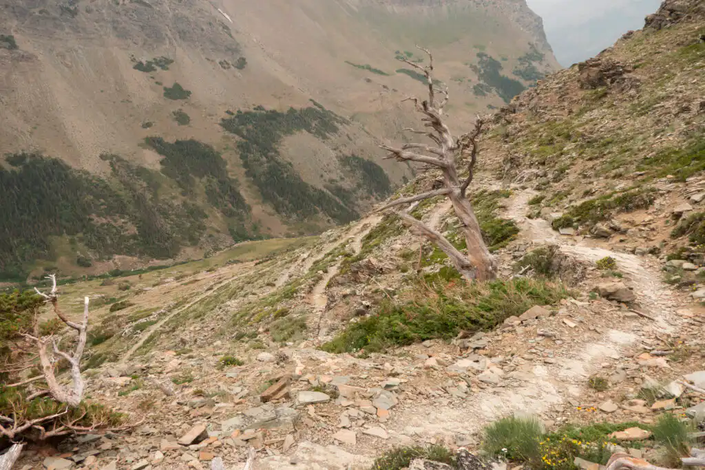
Blister rust and pine beetles have decimated Whitebark Pines in the west. This has left stands of gray, gnarled trees which look so incredible along this trail, sad as it may be (you can find a few still alive higher up on the trail).

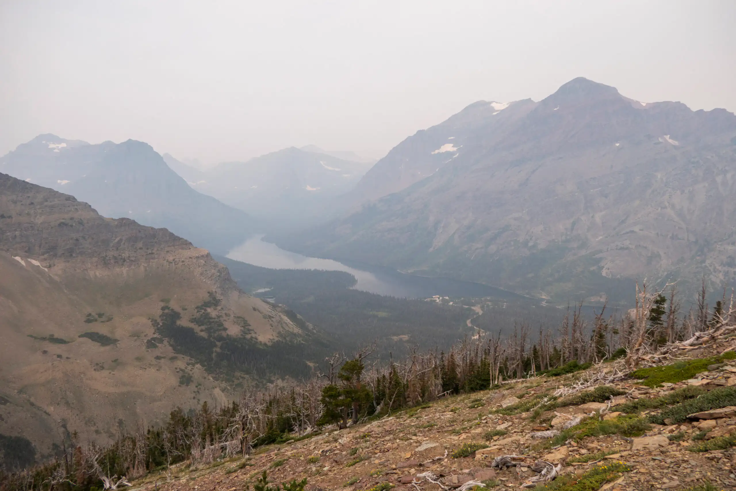
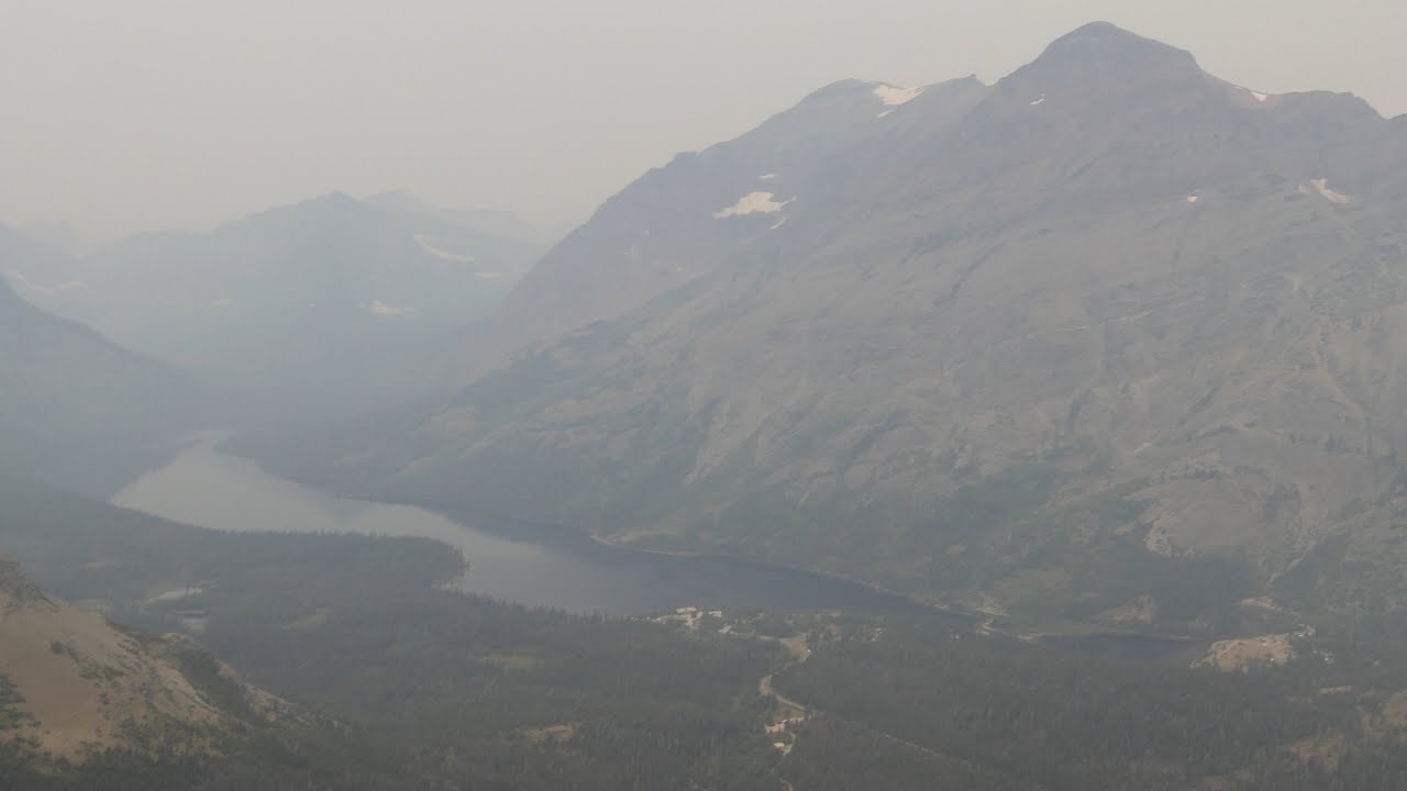
The trail alternates between the open, low growing vegetation, Whitebark Pine stands and stands of Subalpine Fir as it switchbacks up the mountainside. Two Medicine Lake becomes visible as Rising Wolf Mountain towers above it.

Scenic Point Trail switchbacking up and around old Whitebark Pine trees

Eventually the trail comes to a saddle with new views that look down onto Lower Two Medicine Lake and across to Scenic Point itself. A traverse across the hillside lends another variety of plant life and flowers which we enjoyed watching the butterflies dart between.

After the traverse, we traveled across the rolling terrain with Horned Larks tinkling overhead. This point of the trail usually gives sweeping views out to the plains, but the smoke obscured much of those views. After taking the spur trail to the summit, we joined the marmots at the top.

After a snack and a visit with a couple of other folks, we turned around and headed back down finding more birds and more huckleberries. While we saw tracks and scat, we never saw any Bighorn Sheep which was surprising as they frequent the area… and I’ve never been up there and not seen them, but that’s part of the serendipity of getting outside. You just never know what you’re going to get.

This time we got views, flowers, birds, and a few huckleberries which was just fine by us.

Gaillardia

Get our sweet newsletter!

(and your free “10 Insider Tips for Glacier”)

Lists

Comments

19 responses to “Scenic Point 2021”

  1. Lucien Van Elsen Avatar
    Lucien Van Elsen

    Glad you’re back, and you’re all doing well. It’s always pleasant to watch these blogs, and think about getting back out to nature again.

    1. Cindy Peterson Avatar
      Cindy Peterson

      Was at Scenic Point on June 25,2021. Great views then, pre-smoke.

  2. Ron Sisson Avatar
    Ron Sisson

    Great blog, Jake! Keep up the good work. Some food for thought: How about doing a follow-up with a layout similar to Glacier on Mt. Rainier National Park? There are a plethora of great trails with waterfalls, lakes and views of surrounding mountains. Just a thought….

    1. Patty Labenz Avatar
      Patty Labenz

      Agreed! Would love to see a Hike734 map for Mt. Rainer National Park.

  3. J Spence Avatar
    J Spence

    Thanks for the photos (as I sit in an office under fluorescent lights) a lovely reminder of what is beyond this keyboard. I love Glacier so much and your maps have really helped me plan trips out west. The only problem is I lend them to people and never seem to get them back. Guess I will just have to buy more!

  4. Lori Vaas Avatar
    Lori Vaas

    Thanks for posting this, Jake! We’re coming in two weeks and still deciding which hikes to do. Too bad for the haze from the fires – that will probably not go away soon. What is the best way to get to the trailhead for this hike from our hotel on the west entrance. We have a car – but have not had any luck getting shuttle tickets in advance for hiking. Are shuttle bus tickets available to buy there somehow?

    1. Robert Ducanis Avatar
      Robert Ducanis

      Hi Lori,
      Your best bet would probably to take US-2 east to East Glacier. Make a left that takes you under the RR arch and head up to the Two-Medicine entrance. You will pass the Glacier Park Lodge on your left. Nice gift shop, decent food & drinks…..big timber lobby. Scenic Point trailhead is before you get to the Two Medicine campground area and gift shop etc. Take the boat tour if you have time. Another great hike in the area is Dawson-Pitamakan Pass loop. It is long (17 miles?) with about 2400′ climb. I did it 2 years ago with a MT friend. It took about 10 hours the way we did it with stops at Old Man Lake etc. Views were jaw -dropping when we reached Pitamakan Pass. Wind was pretty intense at the Dawson Pass, but only at 3 or 4 exposed switchbacks. We were able to catch the last boat to chop a couple of miles off of the hike.

      If you drive back the same way, you might want to consider a bite to eat and a drink at the Izaak Walton Inn at Essex.

      Bob D.
      Winter Park, FL

  5. RICH WHITING Avatar
    RICH WHITING

    Great post Jake! Hope you and Kristen are doing well. Scenic Point was the first hike Cheryl and I did on our first trip to Glacier. To this day the “wow” factor we felt climbing higher has never left us. A very special place – can’t wait to get back! “A little early smoke” is a bit of an understatement, but this too shall pass. So glad to see new blogs and videos from you – keep ‘em coming!
    Rich and Cheryl Whiting

    1. hike734 Avatar

      When the sun was lower, it was hazier. As the sun got higher, it got better. Two days later the haze cleared out and I had a great hike up McDonald Creek. Look for that blog soon.

  6. Nice! We’re looking forward to our first visit next month.

    1. hike734 Avatar

      Enjoy!

  7. Either I’m missing it or it’s not there but I’m always interested in length of hike and the elevation gain/loss of a hike. That makes or breaks whether I do a hike or not.

    1. hike734 Avatar

      Sorry to not include that here Vicky. You can find all of the distances of the hikes (as long as I’m doing the standard hike) at the hiking page for each park. In particular, the Glacier hikes are listed here: https://hike734.com/hiking/ and you can find Scenic Point under there which will take you to here: https://hike734.com/hiking/scenic-point/

  8. Thanks for making this video. Kind of glad I decided not to go to GNP this year because of the smoke & crowds. Maybe next year.

  9. Carol Higgins Avatar
    Carol Higgins

    We will be coming to Glacier August 14th. This is our first trip there and I am so very excited!!! I have several of your maps Glacier, Going to the Sun Road, Yellowstone, Tetons and Zion!! I have been studying over these maps for days! I hope the smoke clears by the time we get there!! Thank you for all your information!!

  10. Thanks Jake,

    We love the scenic point hike. With it’s southern exposure, it melts out quicker than many of the high ridge hikes in the park. We just got back from 2&1/2 weeks on the eastside. We had both clear and smokey days. While the long range views were affected, the views of the vicinity were fine.

    Scott Bracewell
    ATL

  11. Love your blog and videos. I have worked in the Apgar Visitor Center for 10 years and send many people to your website. My hiking is limited, so I really enjoy your video’s. Gives me more “first hand” knowledge as to what the hike looks like so I can share that with visitors. Keep up the good work. Thanks.

  12. Thanks for the video. Your blog is consistently the best resource for hikers coming to Glacier. Great job!

  13. Thank you for producing these maps! If you are looking for ideas, it would be nice to have maps of hiking trails in National Forests, especially those in the vicinity of National Parks that are limiting entrance (e.g., Rocky Mountain National Park).

Leave a Reply

Your email address will not be published. Required fields are marked *

This site uses Akismet to reduce spam. Learn how your comment data is processed.